1940 Census Tract Maps
These maps come from 16th census of the United States, 1940. Population and housing. Statistics for census tracts, [city]. The print copies are held in the ALF in three volumes: Akron - , Duluth - , and Oaklahoma City - .
Front Matter
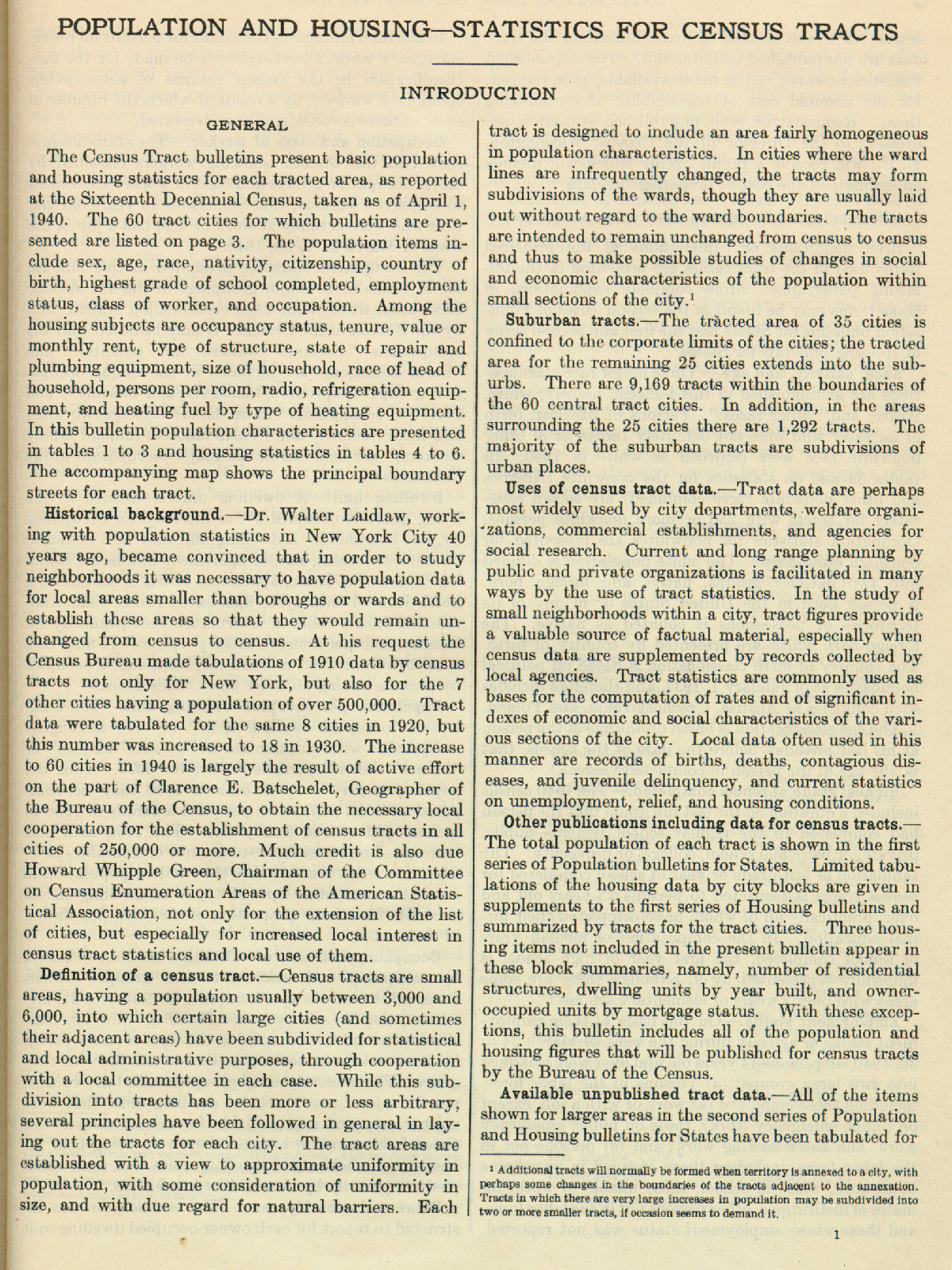
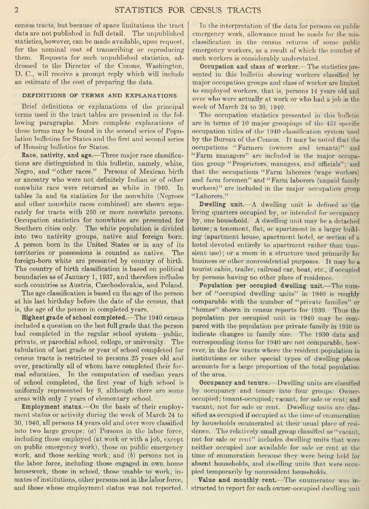
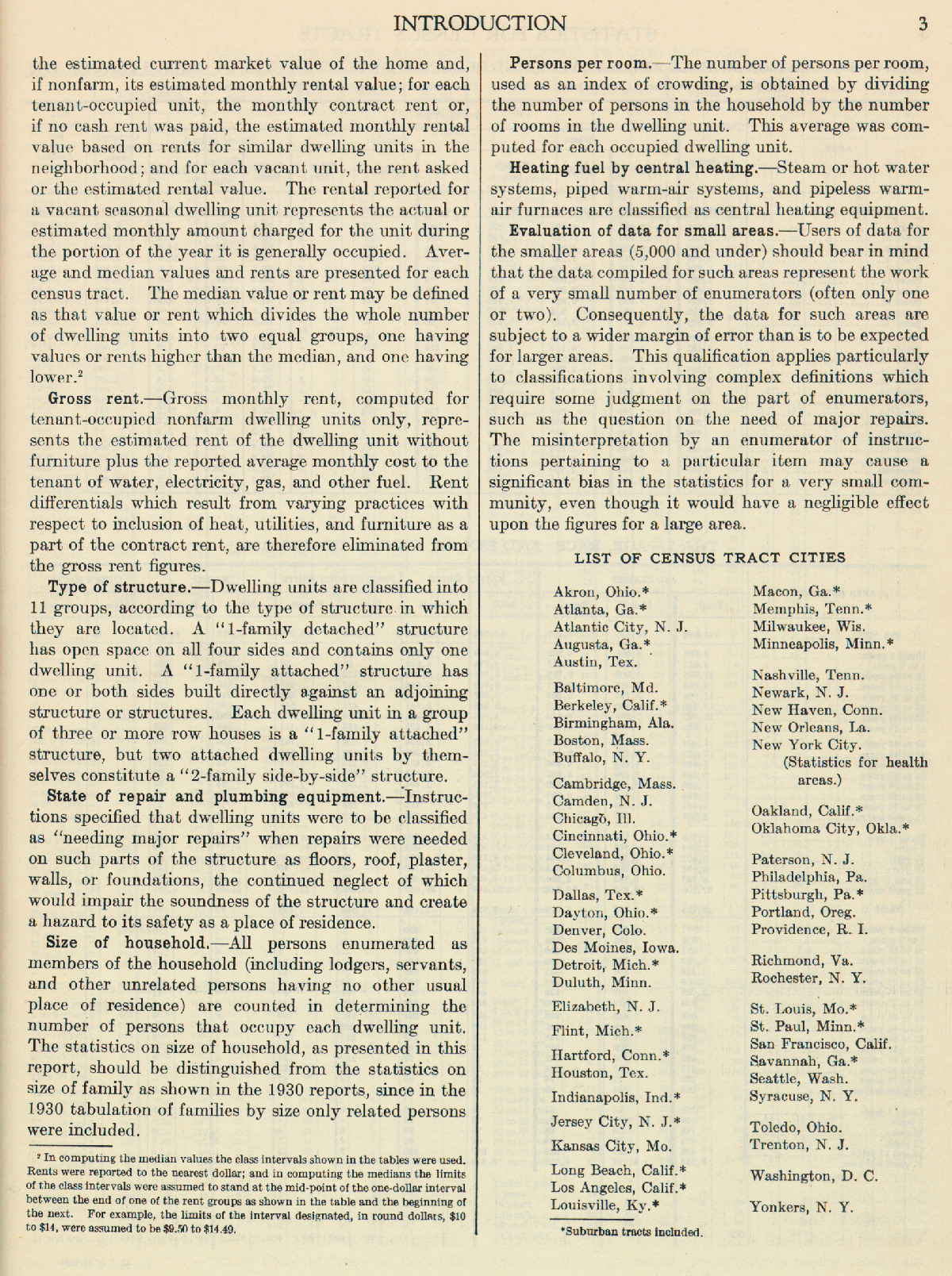
All volumes contain the same front matter, reproduced here.
Maps
Clicking on the names will bring up the map. Clicking on the ![]() will bring up the full text in the HathiTrust.
will bring up the full text in the HathiTrust.
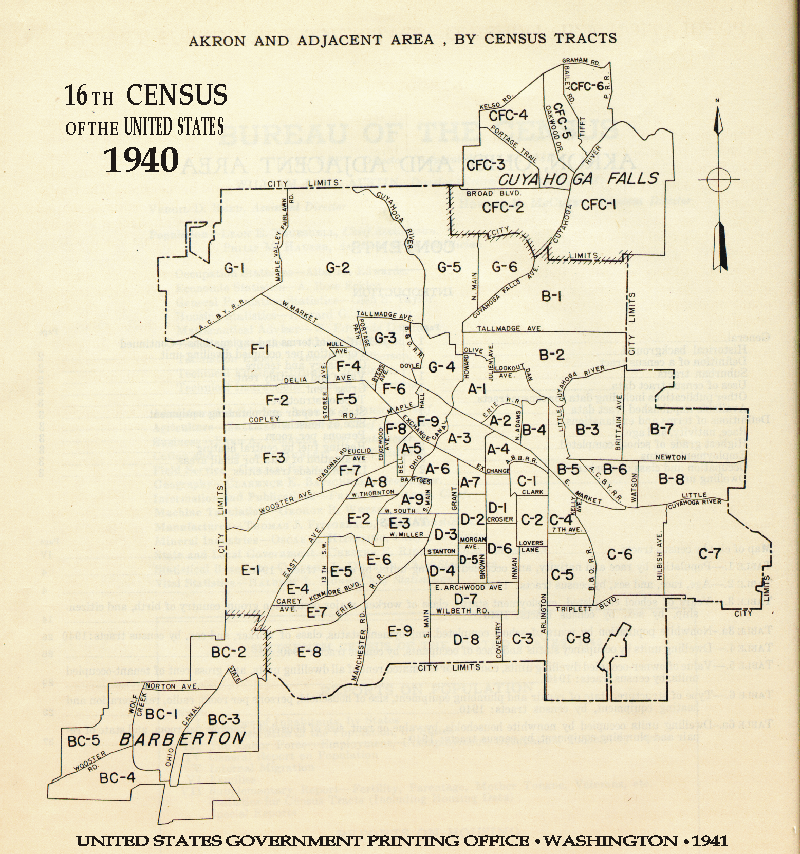
- Akron, OH

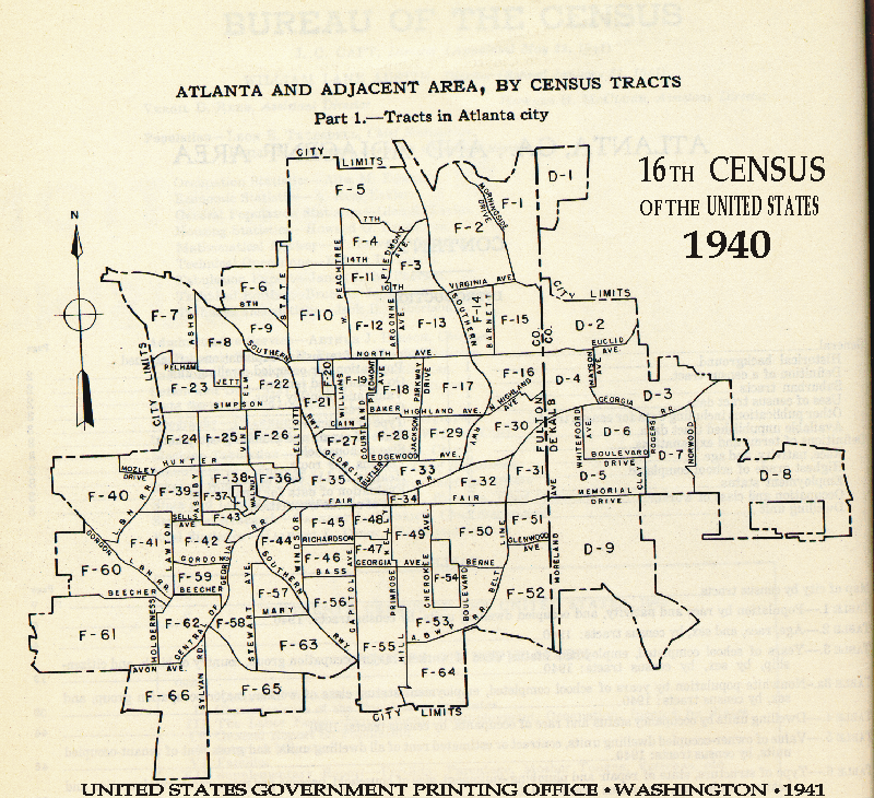
- Atlanta
- Atlanta Area
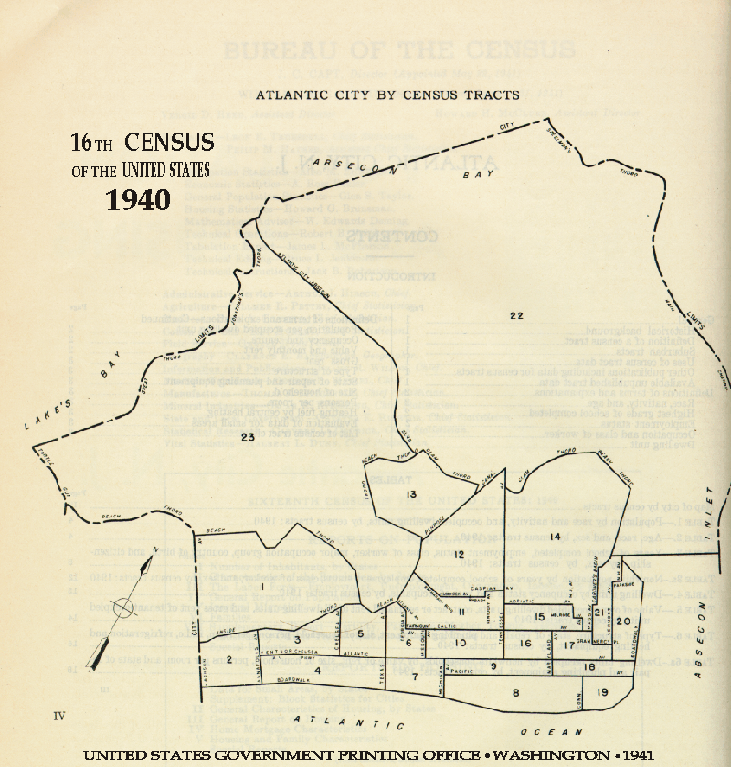
- Atlantic City
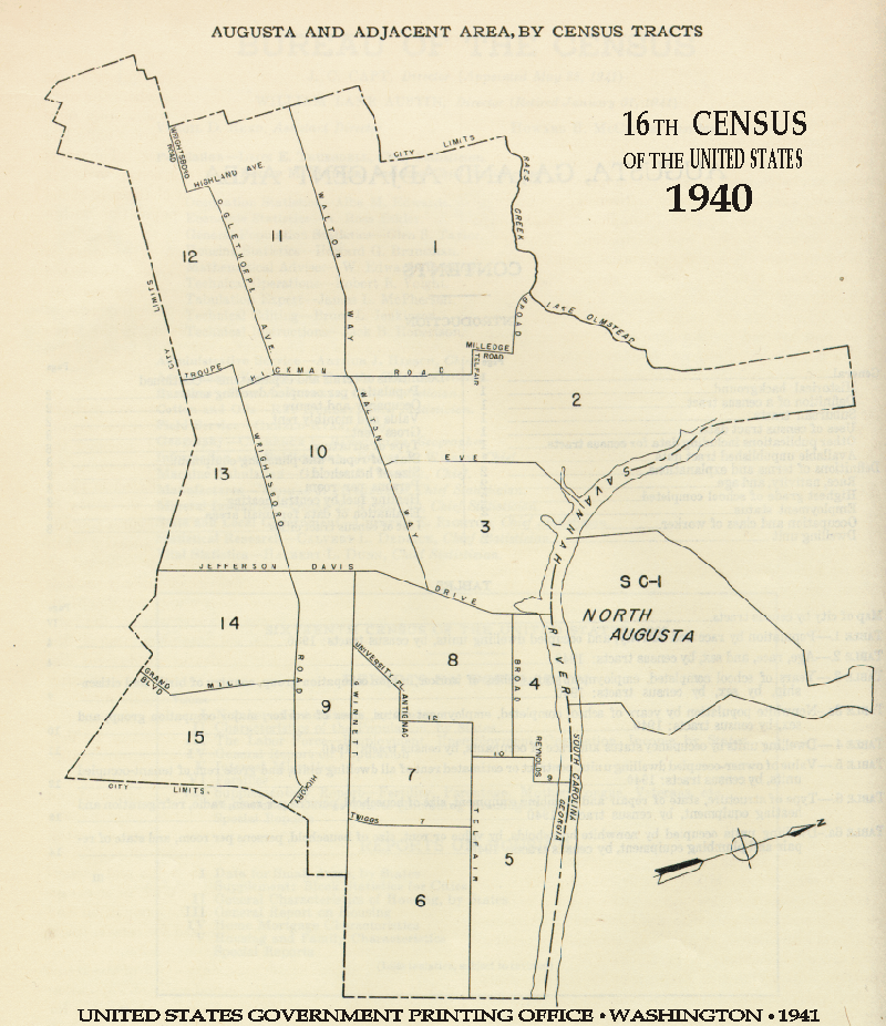
- Augusta, GA
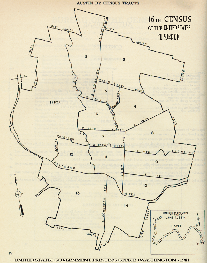
- Austin, TX
- Baltimore
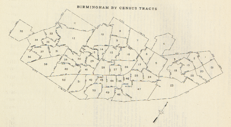
- Birmingham
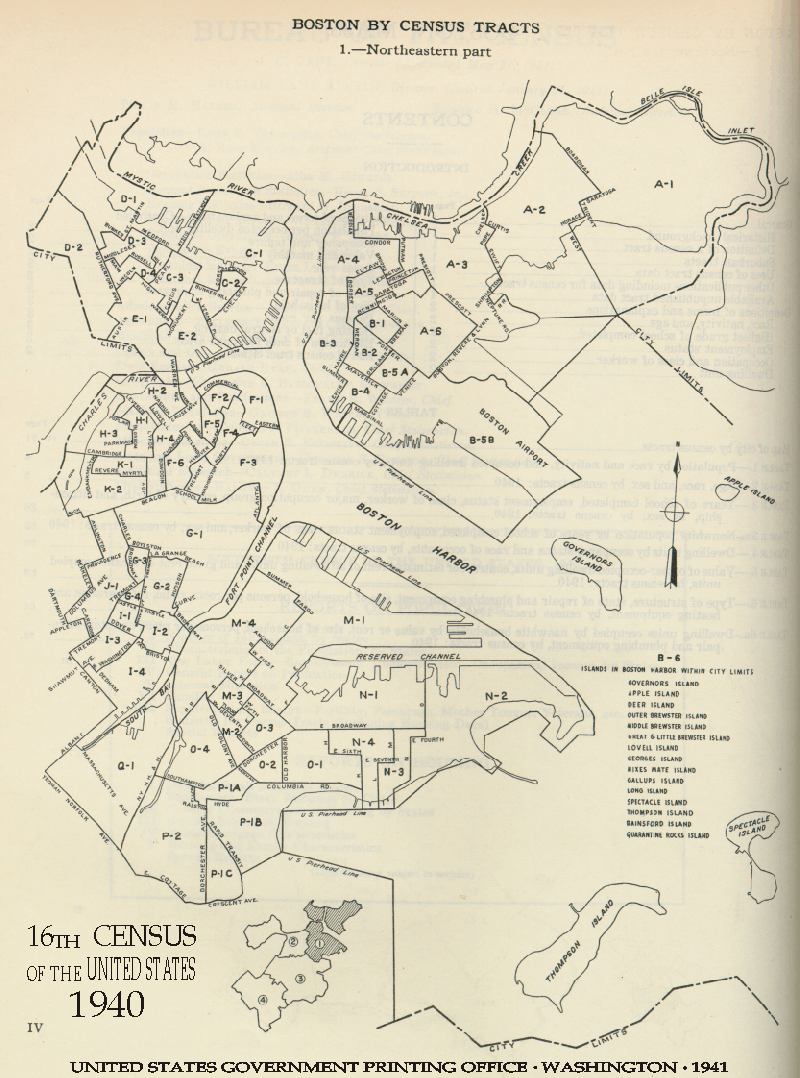
- Boston NE
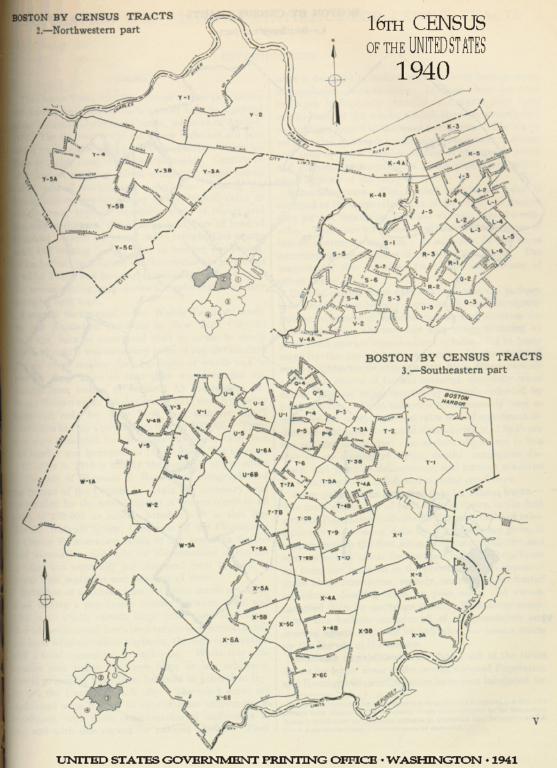
- Boston NW & SE
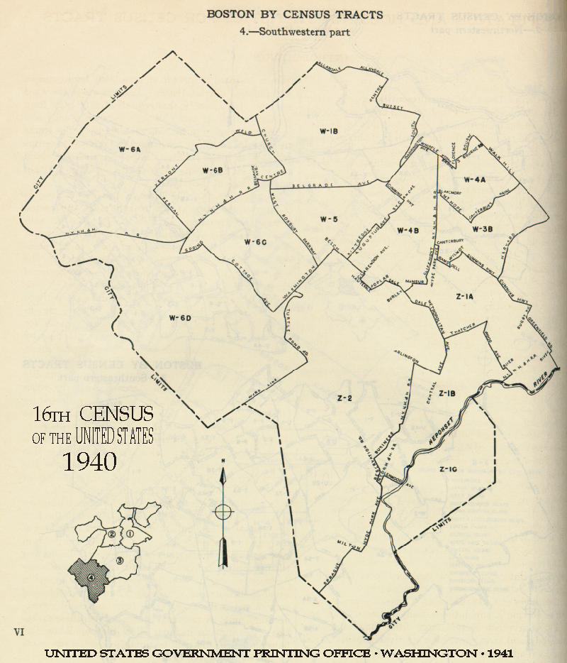
- Boston SW
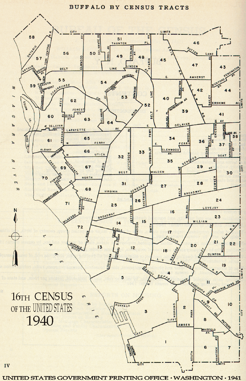
- Buffalo
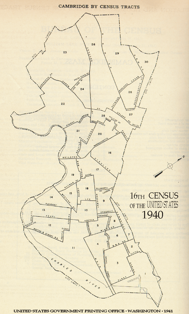
- Cambridge
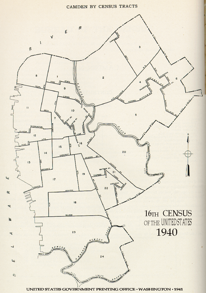
- Camden
- Chicago North
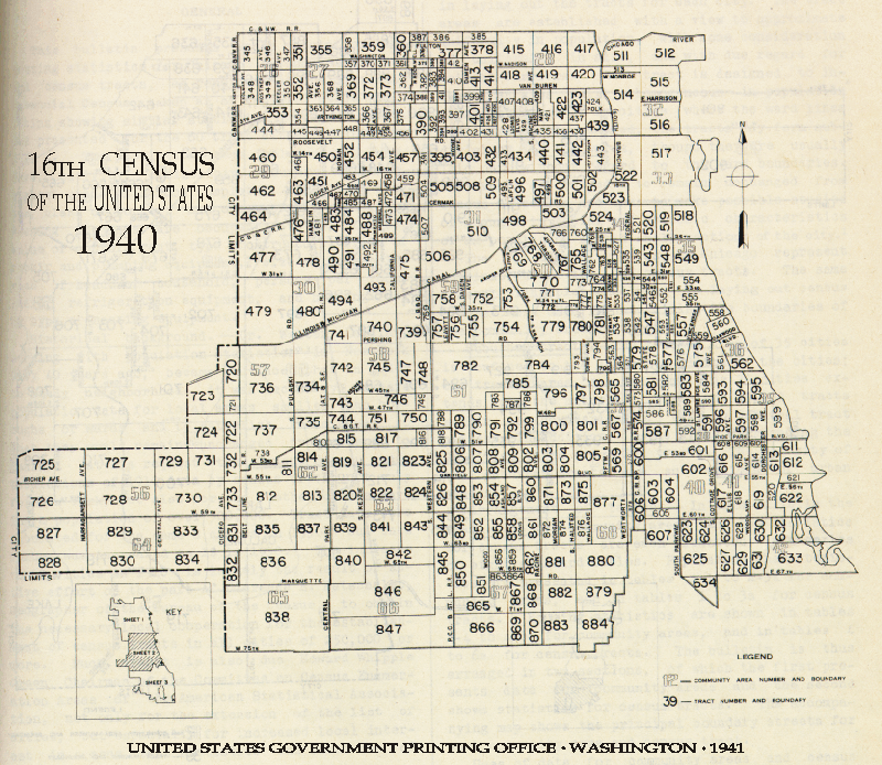
- Chicago Midtown
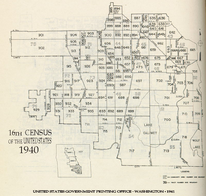
- Chicago South
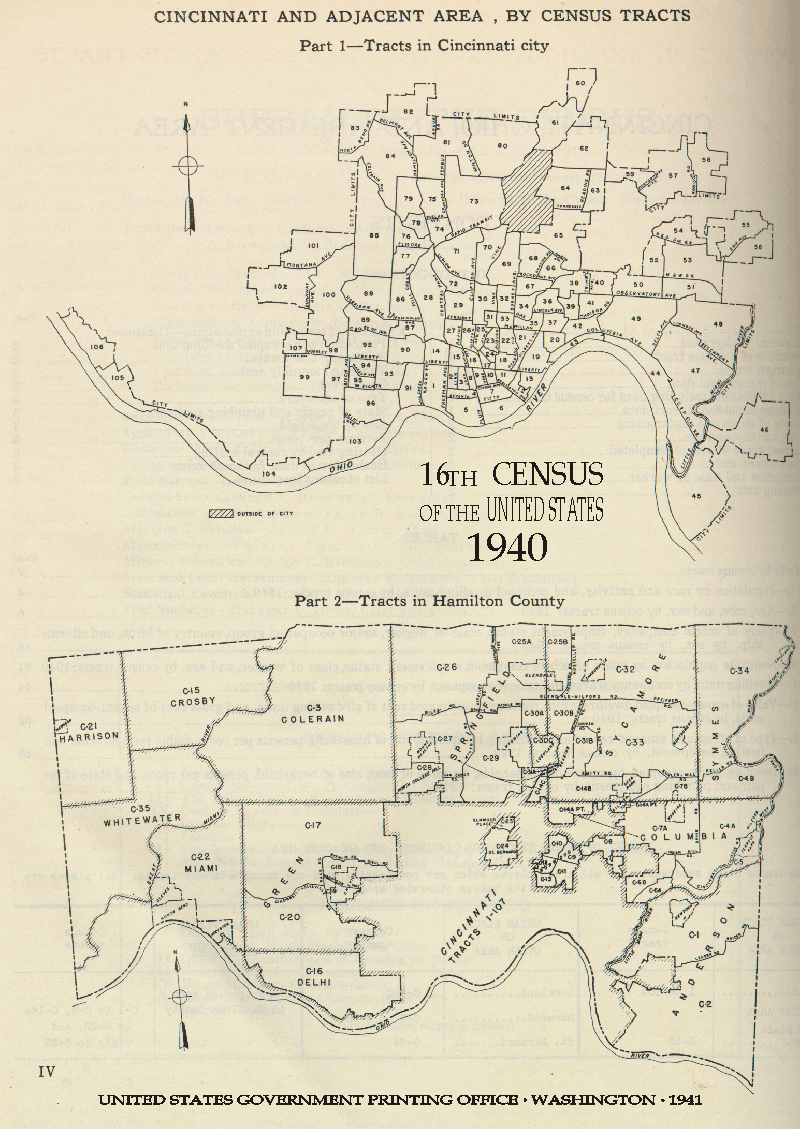
- Cincinnati
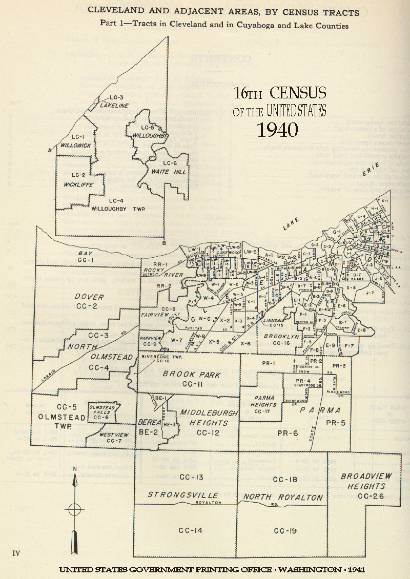
- Cleveland West
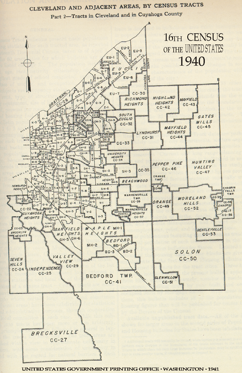
- Cleveland East
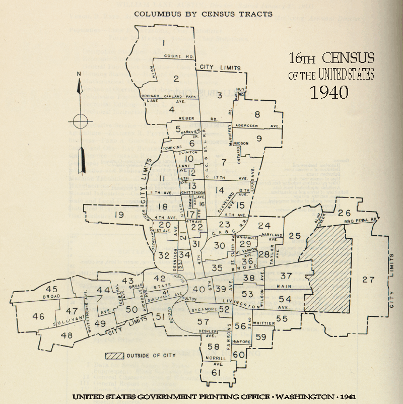
- Columbus
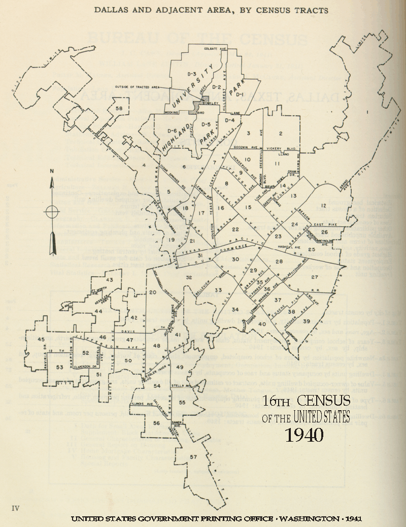
- Dallas
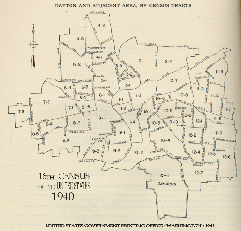
- Dayton
- Denver
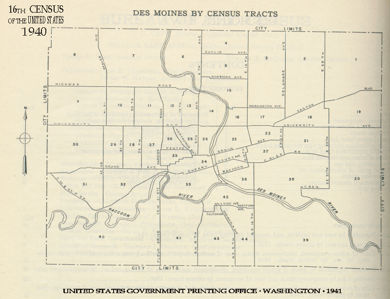
- Des Moines
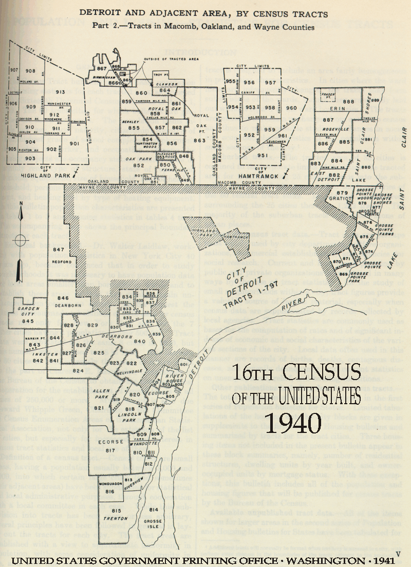
- Detroit
- Detroit Area
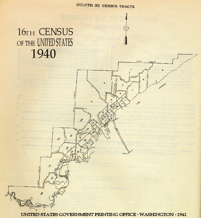
- Duluth
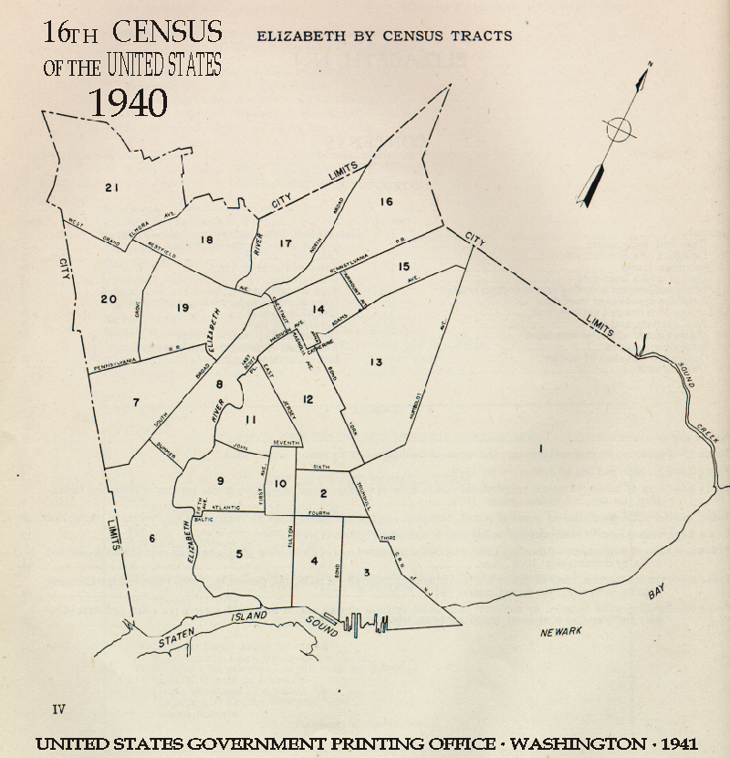
- Elizabeth, NJ
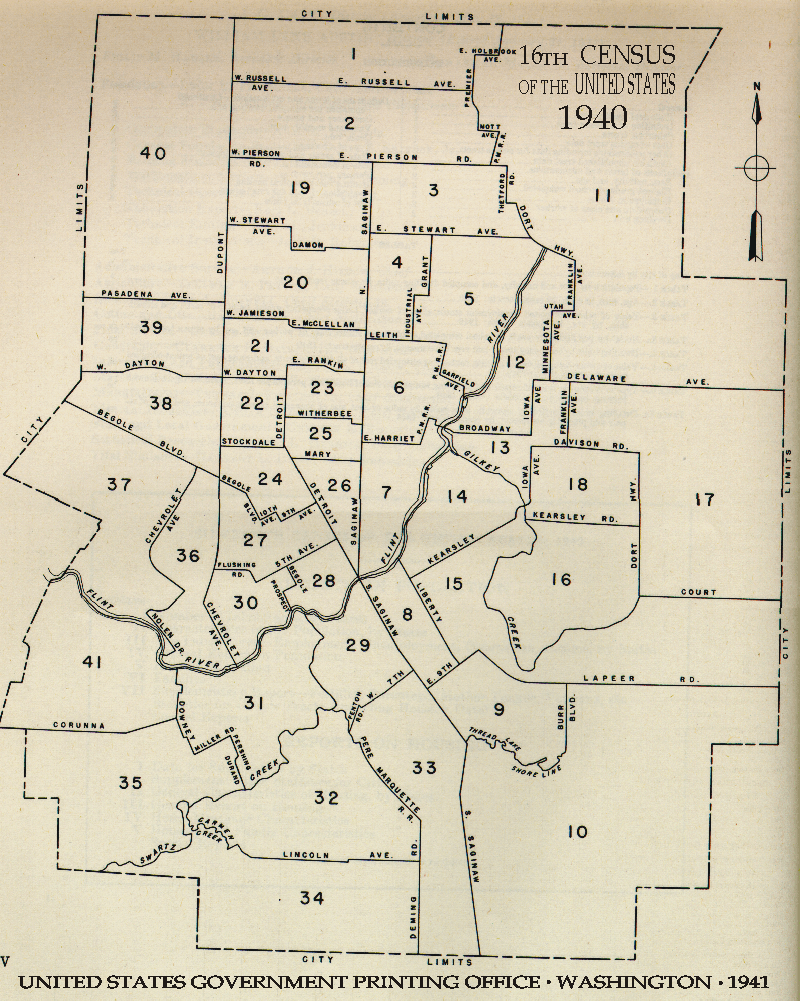
- Flint
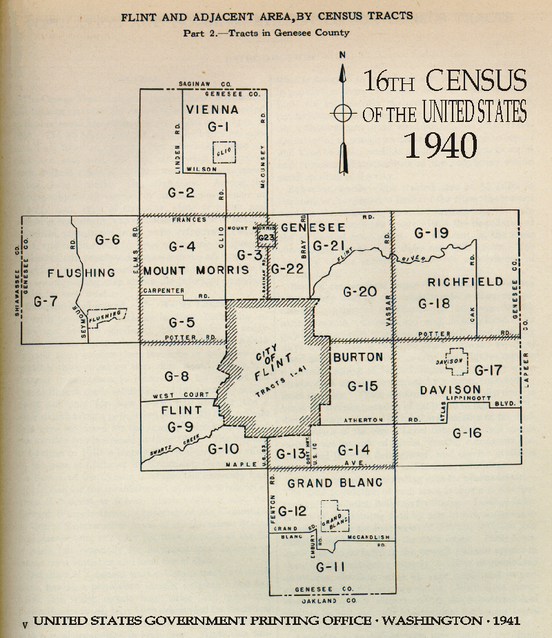
- Flint Area
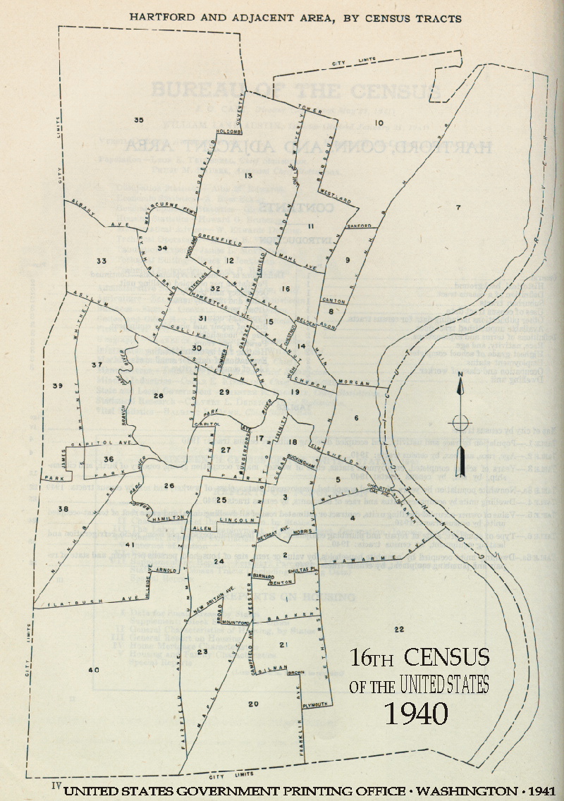
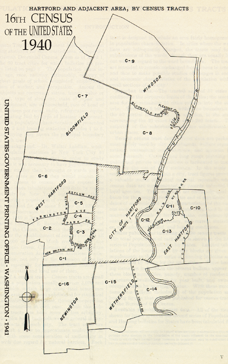
- Hartford
- Hartford Area
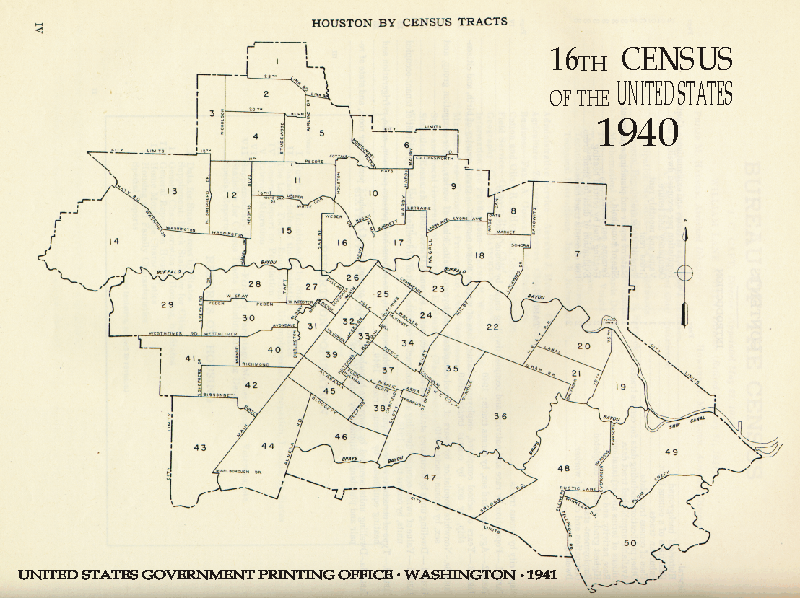
- Houston
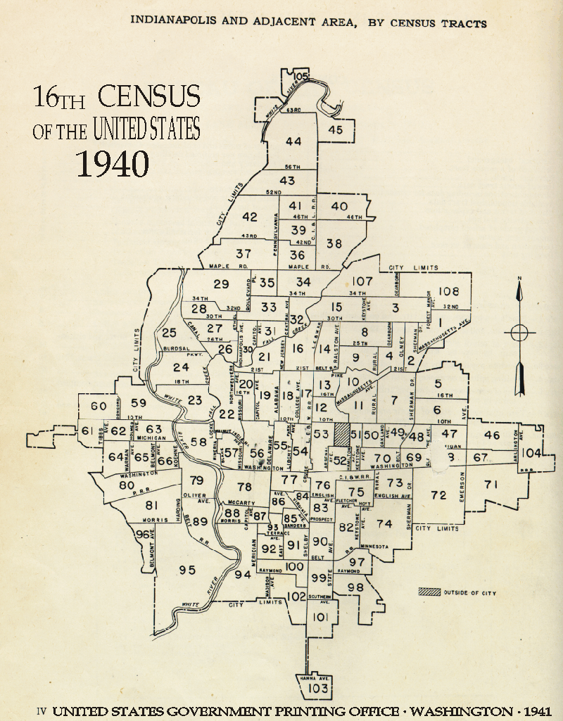
- Indianapolis
- Indianapolis Area
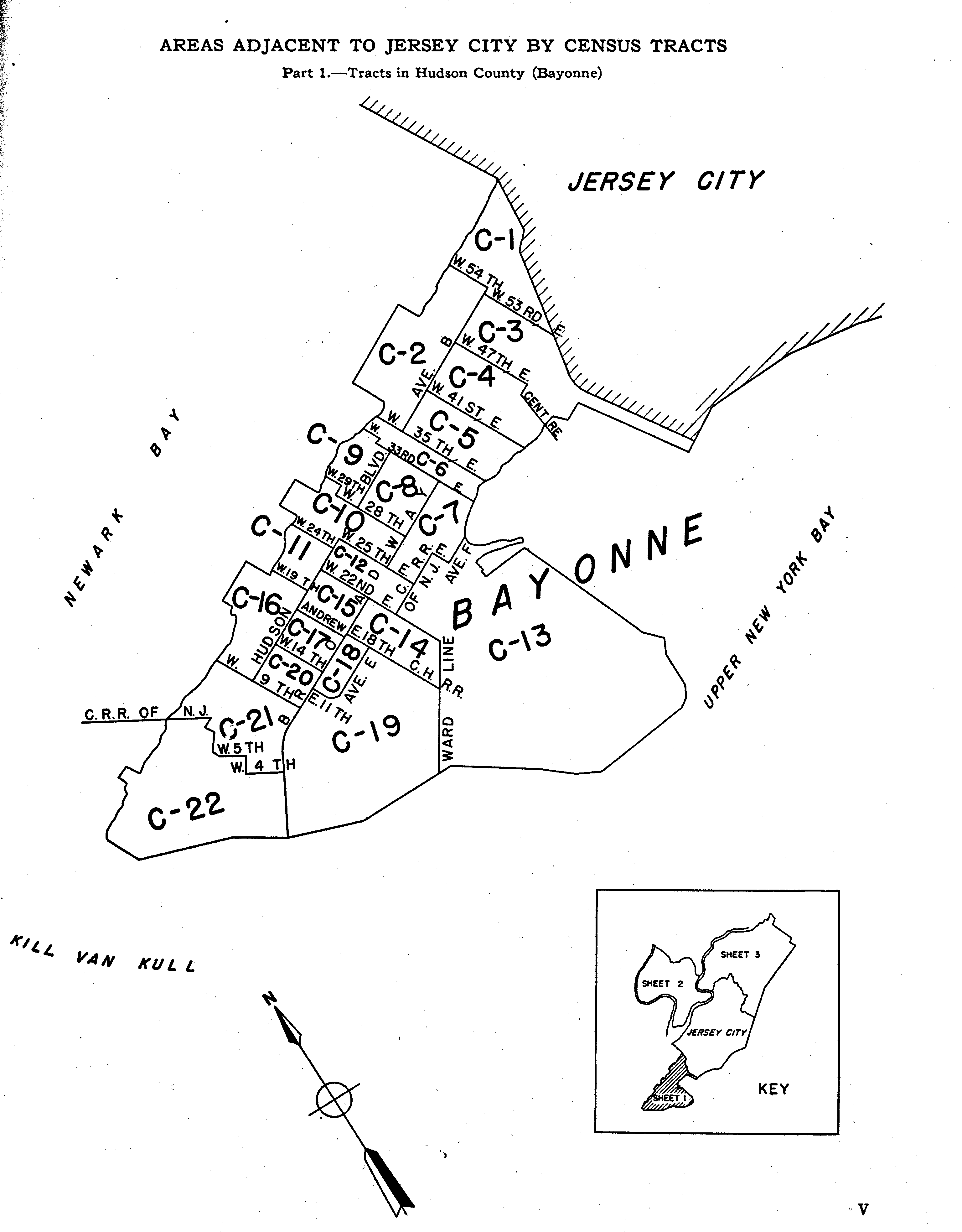
- Jersey City
- Jersey City Area 1
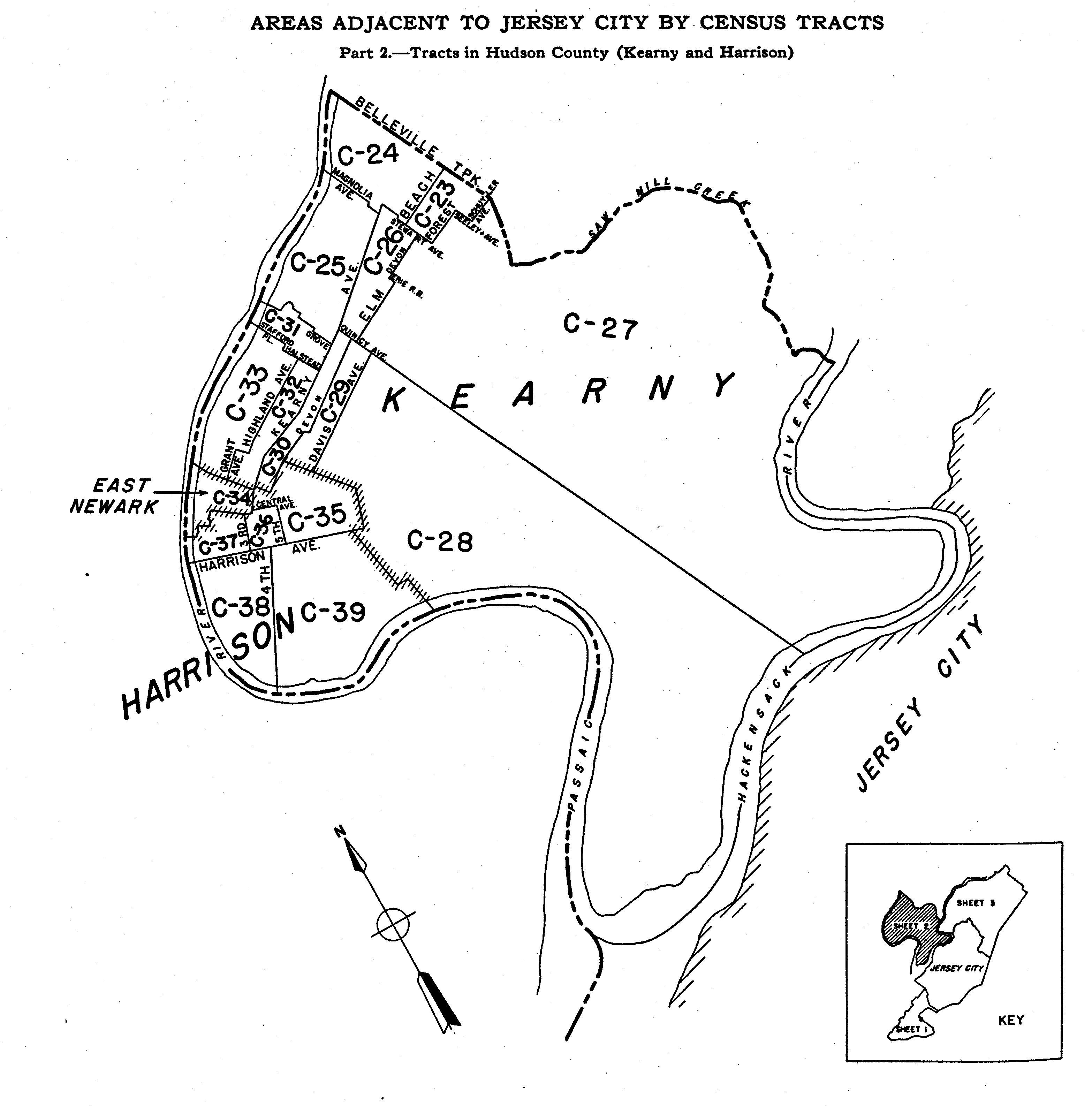
- Jersey City Area 2
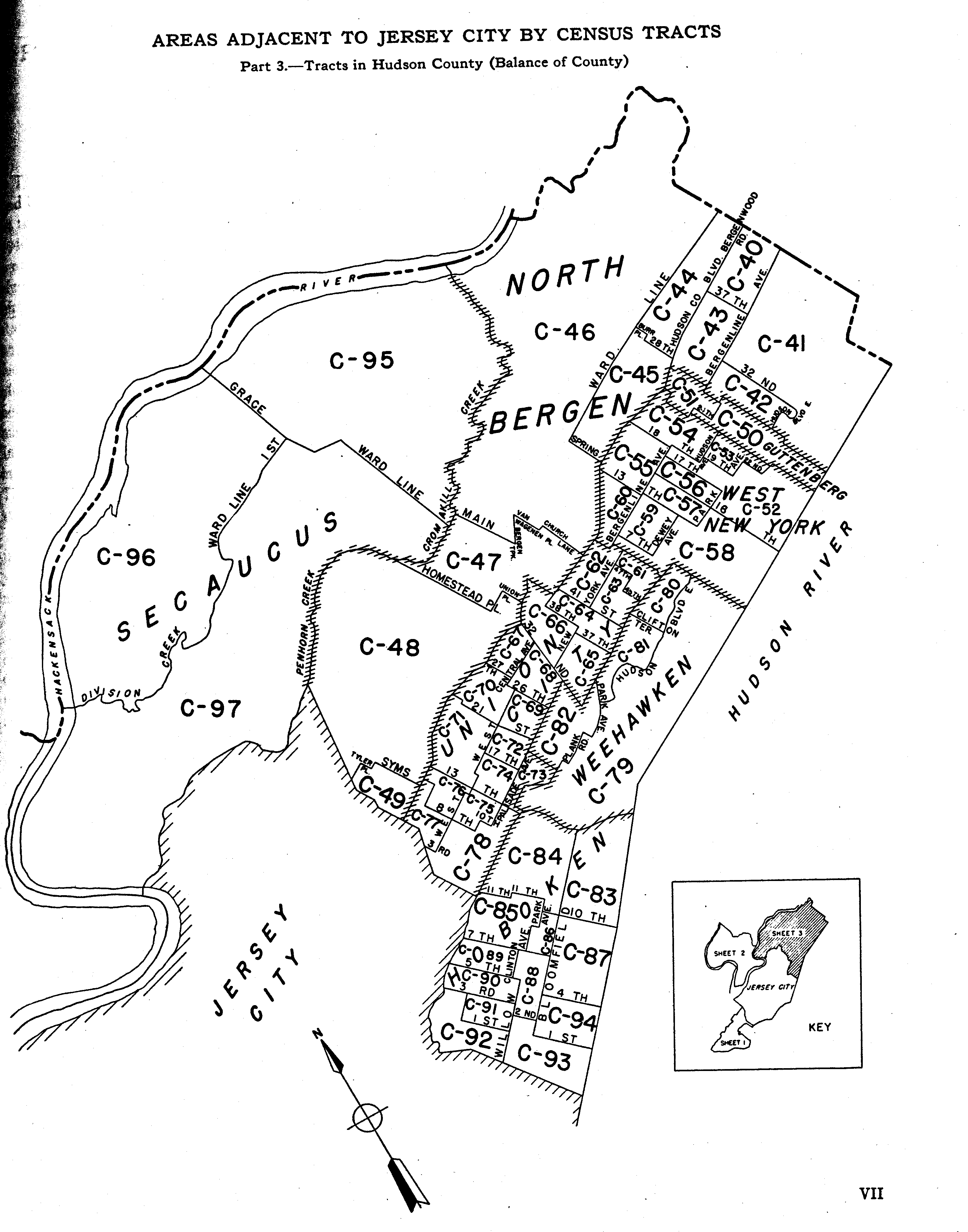
- Jersey City Area 3
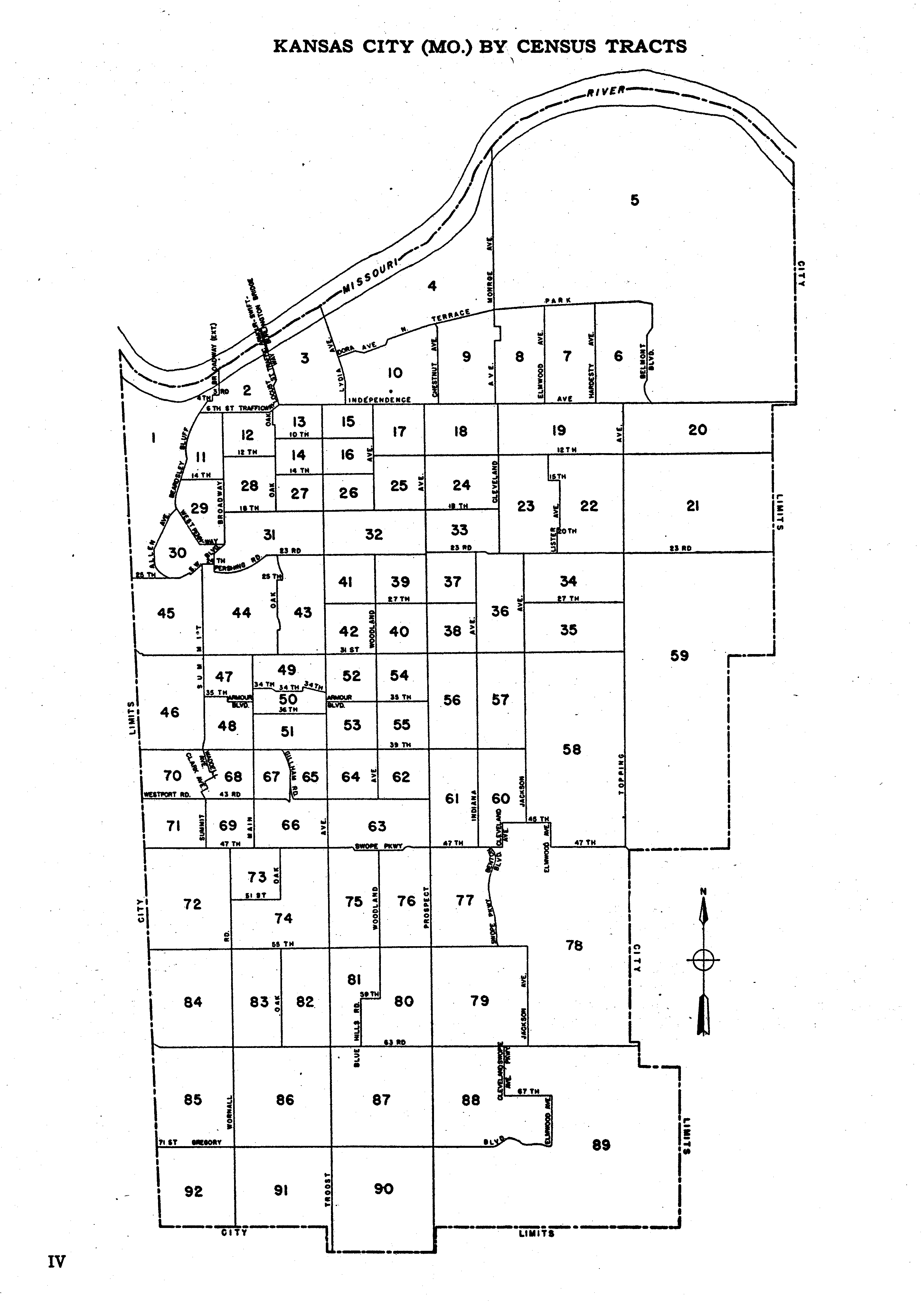
- Kansas City
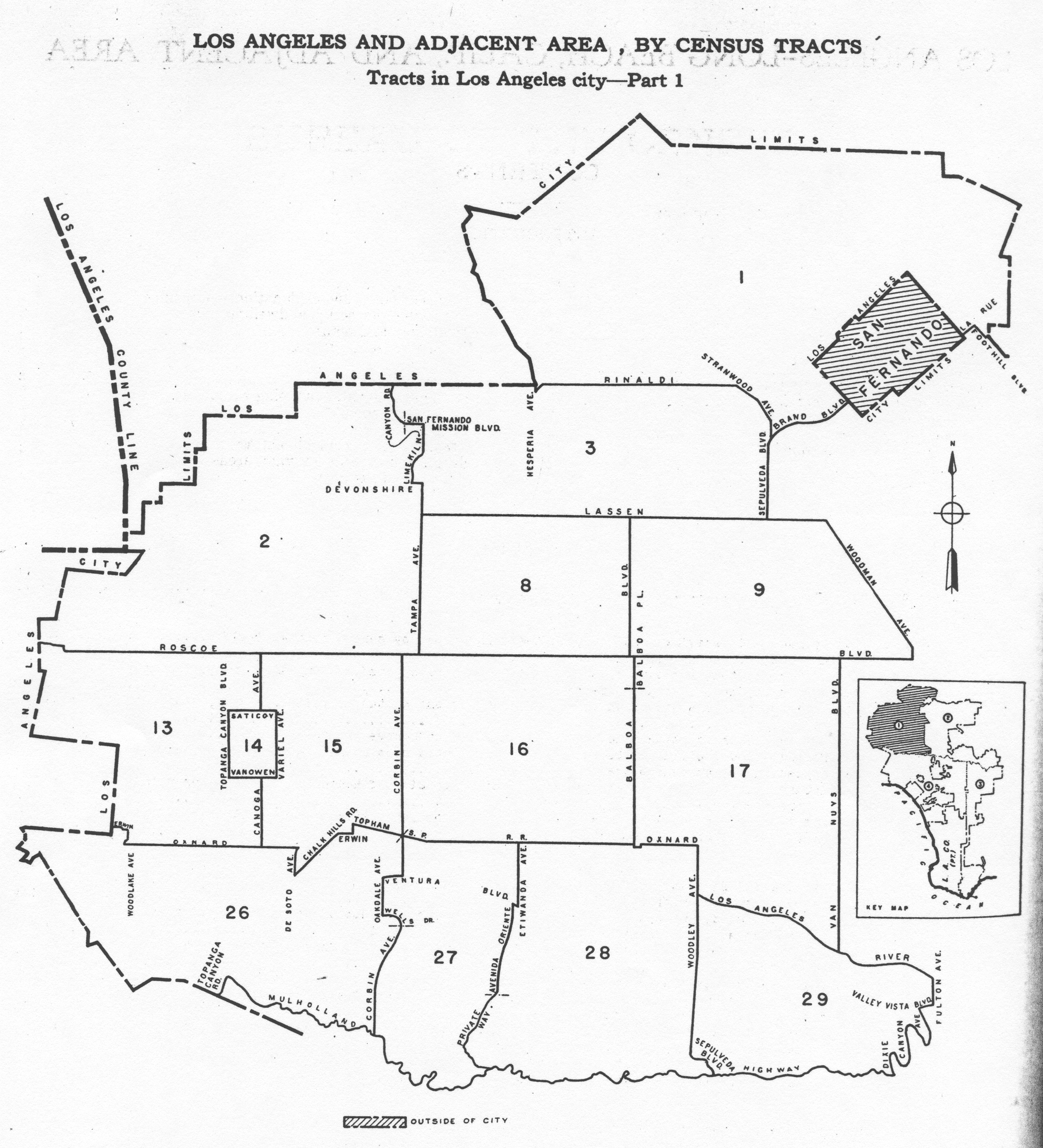
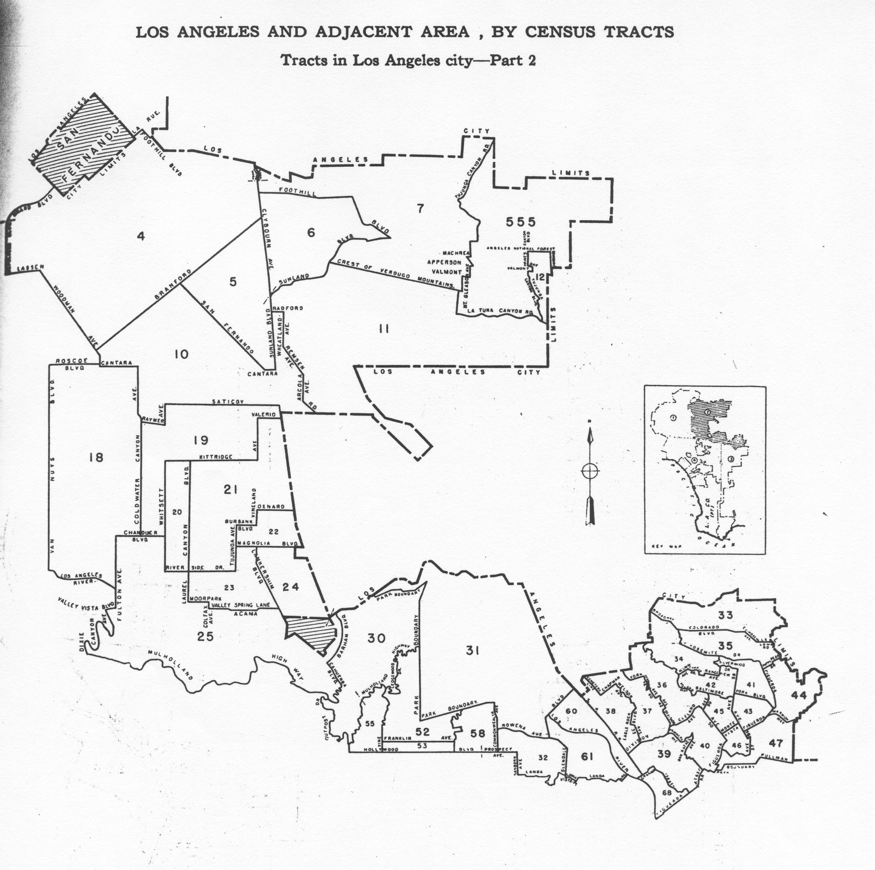
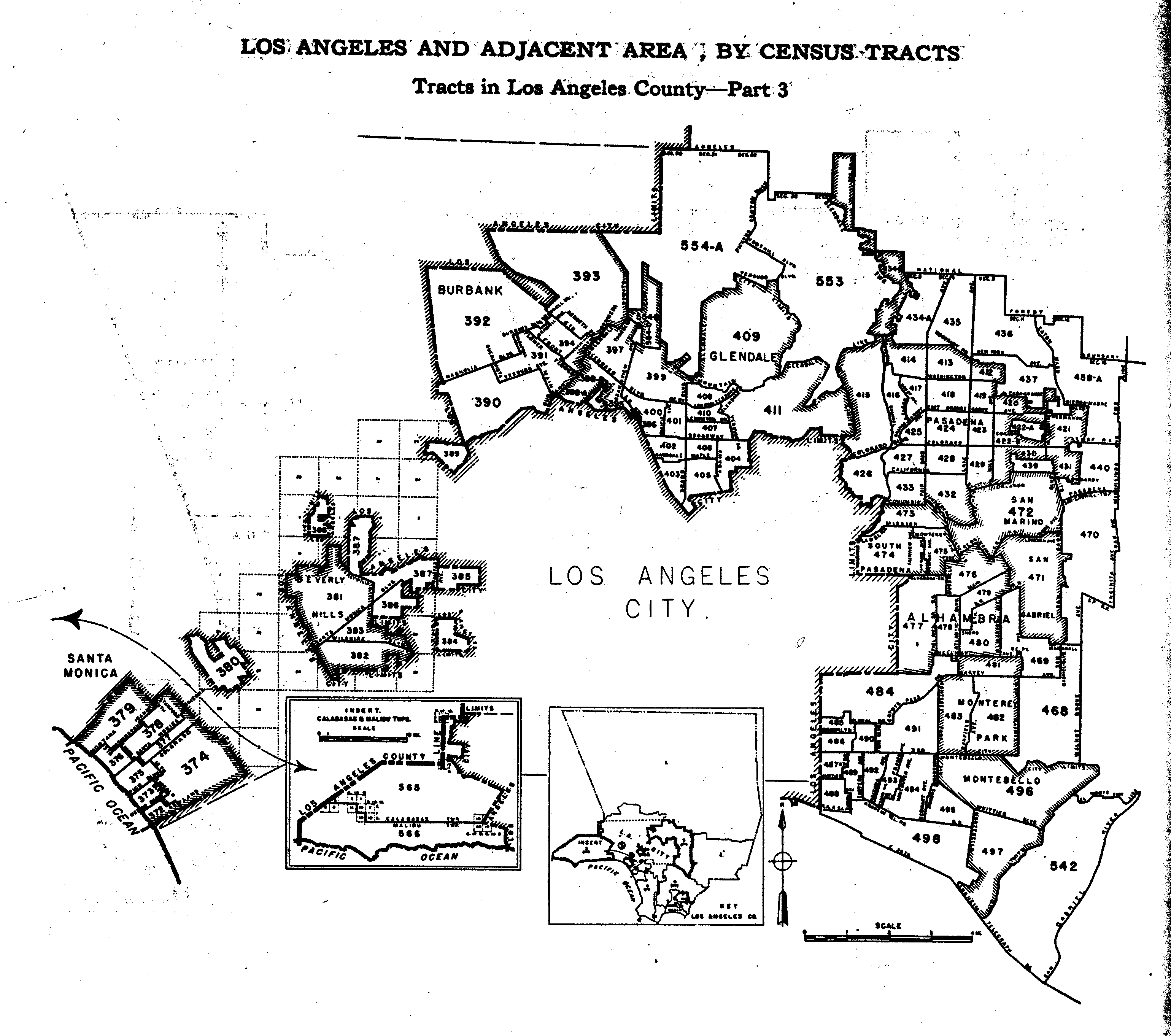
- Los Angeles 1
- Los Angeles 2
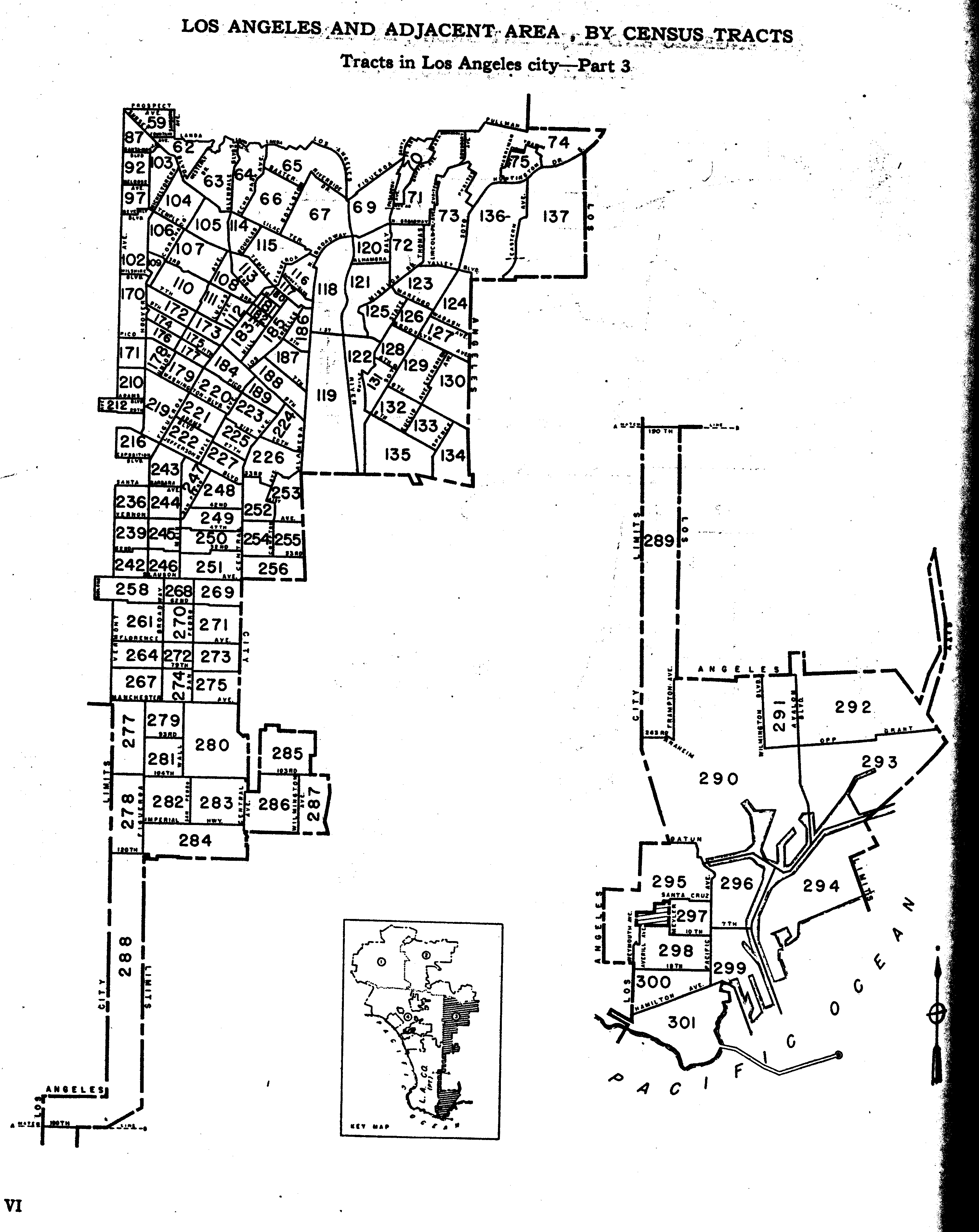
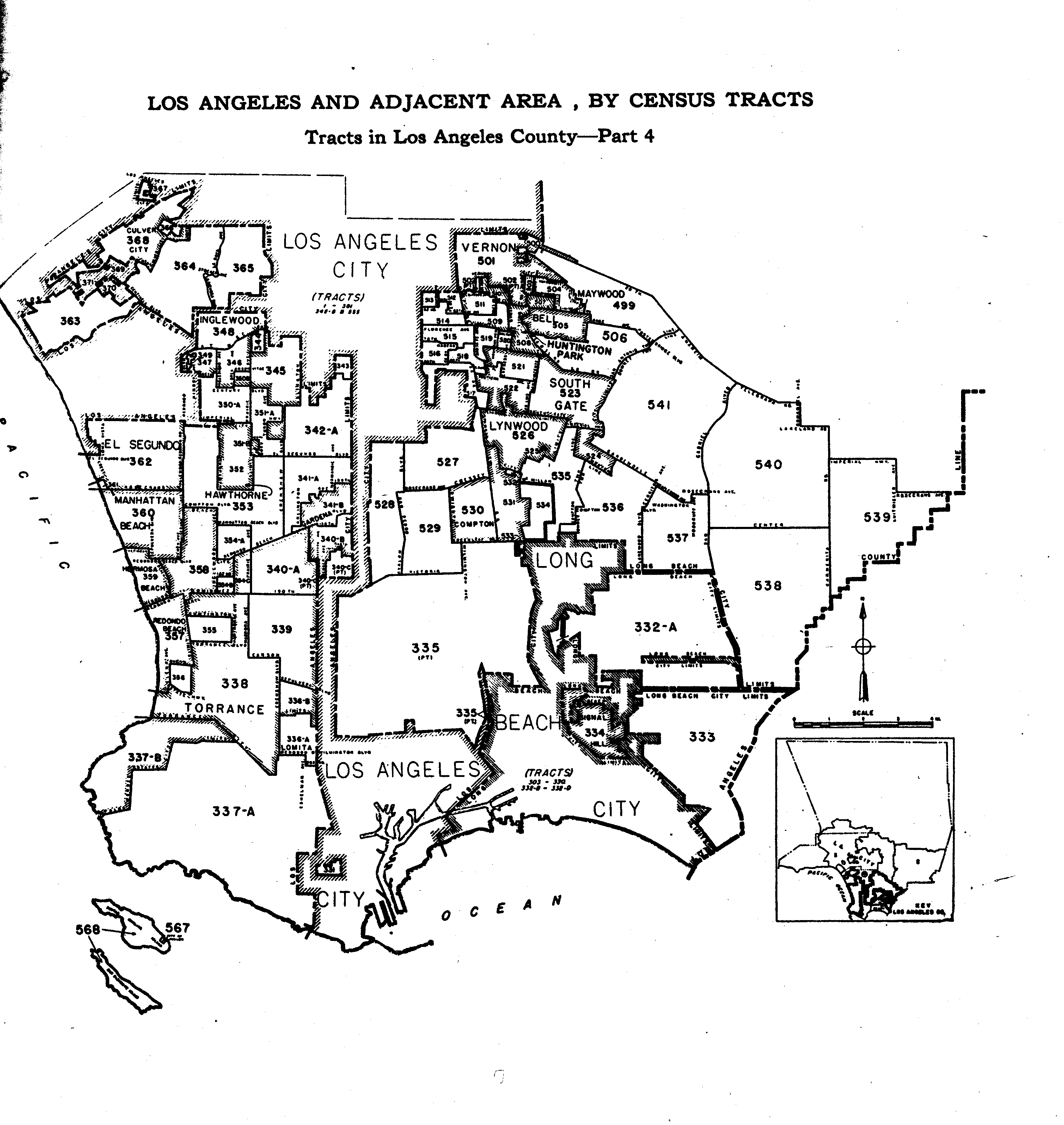
- Los Angeles 3
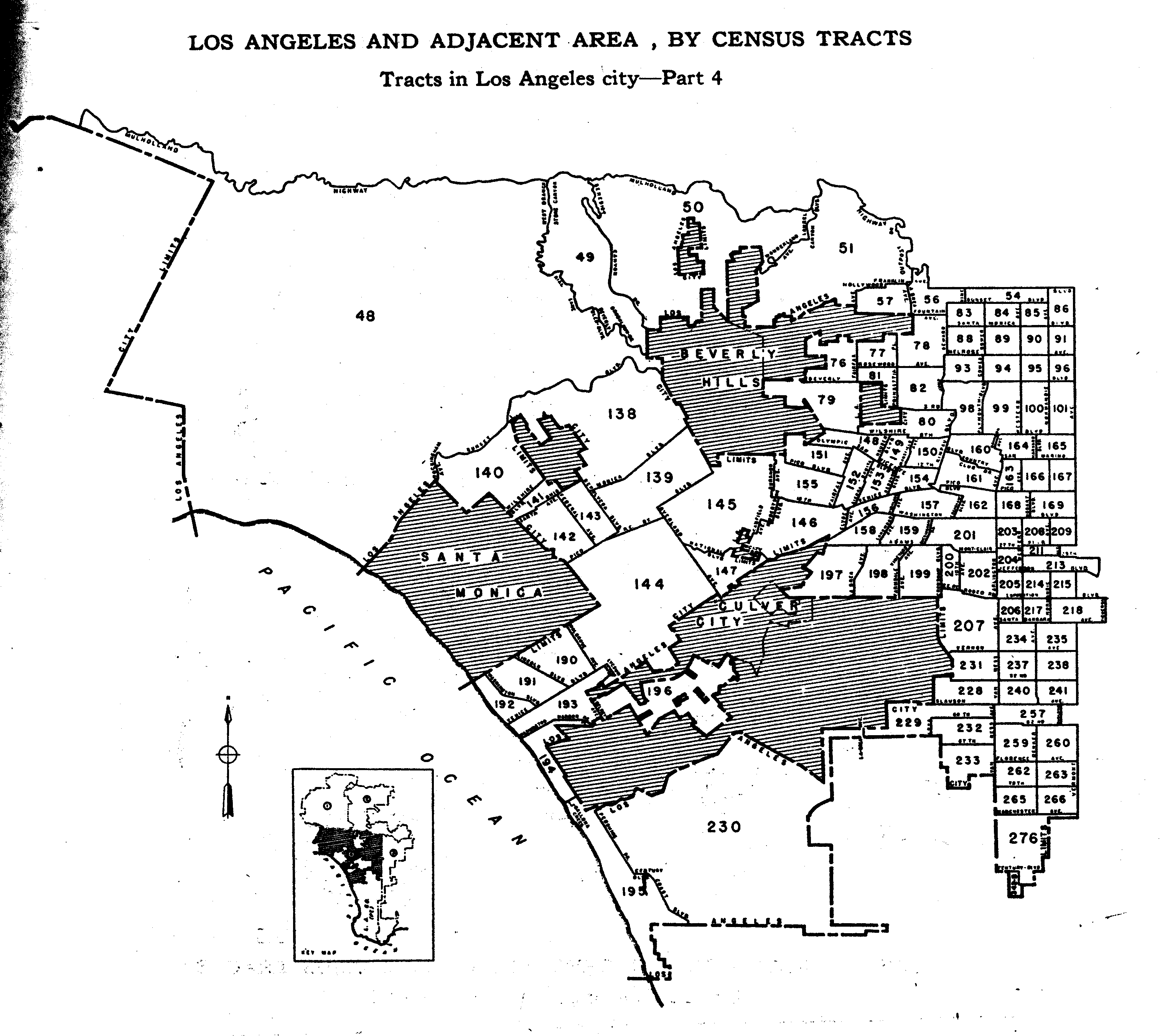
- Los Angeles 4
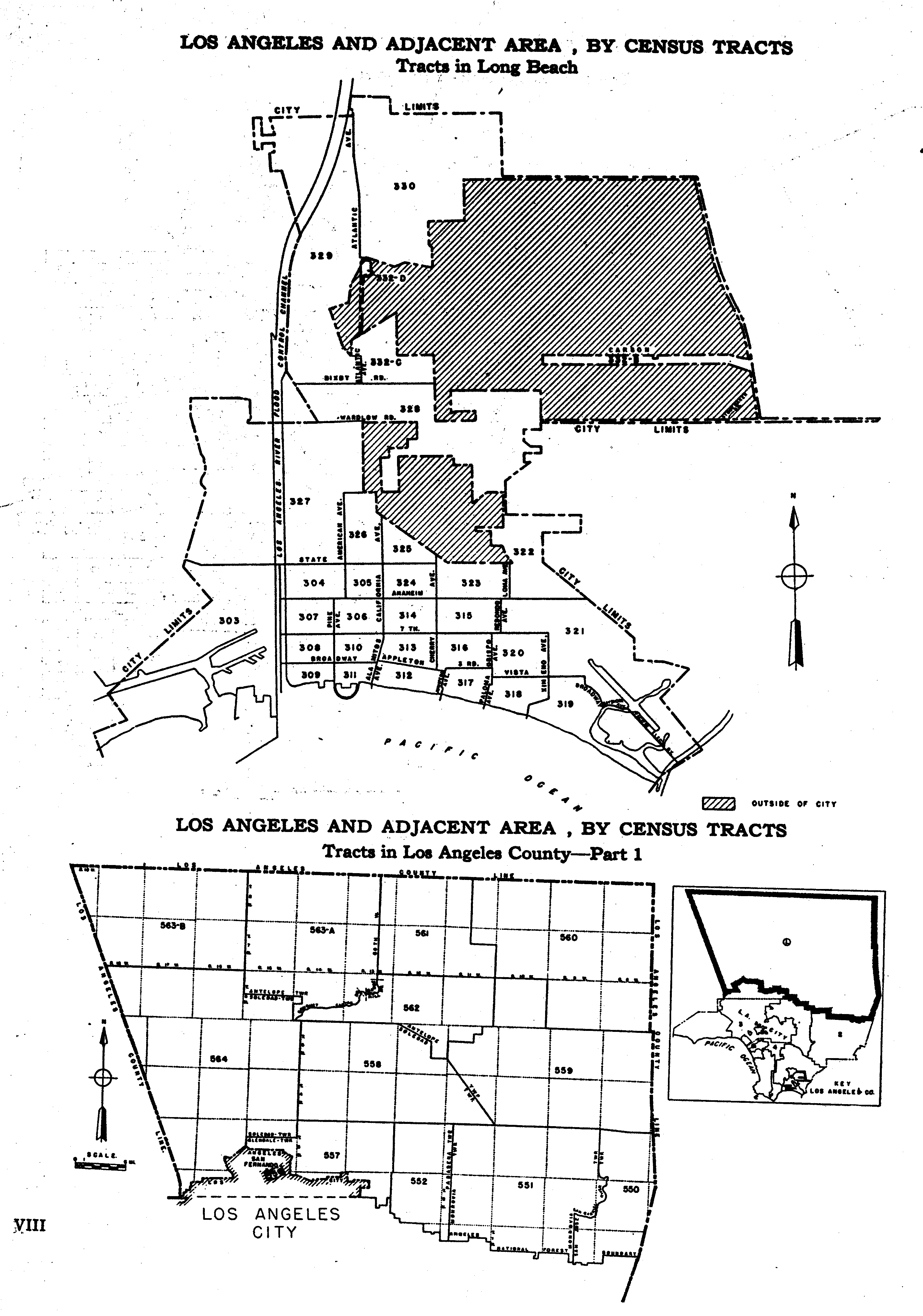
- Long Beach
- Los Angeles Area 1
- Los Angeles Area 2
- Los Angeles Area 3
- Los Angeles Area 4
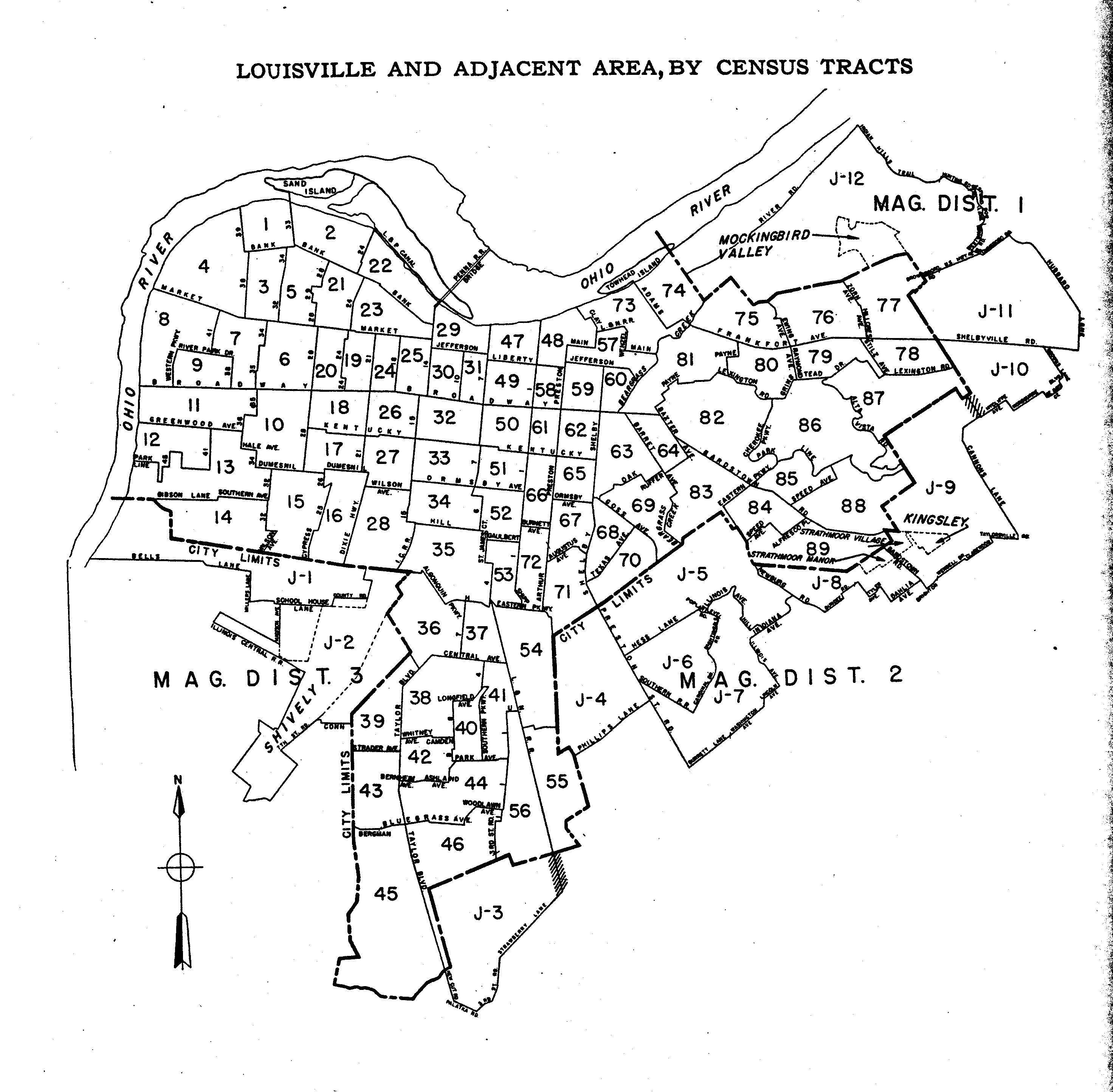
- Louisville
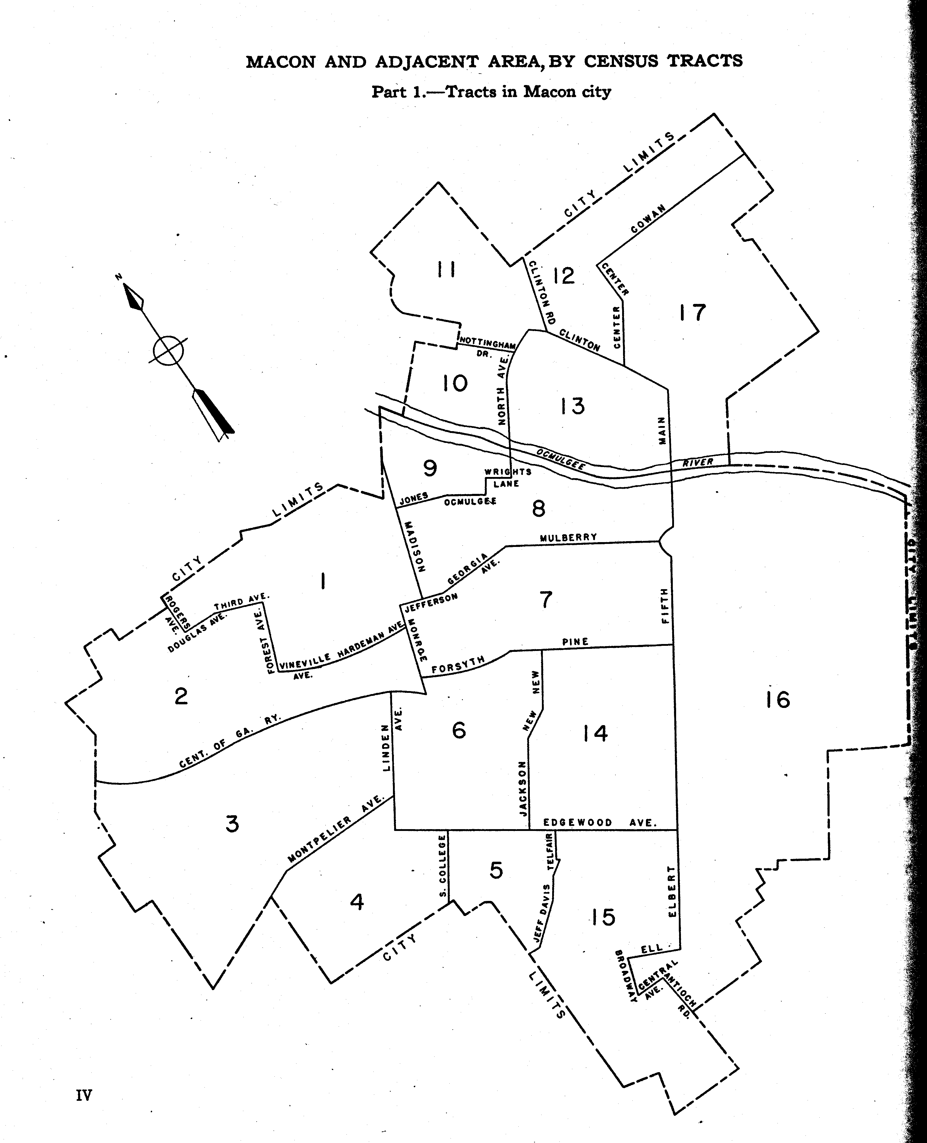
- Macon, GA
- Macon Area
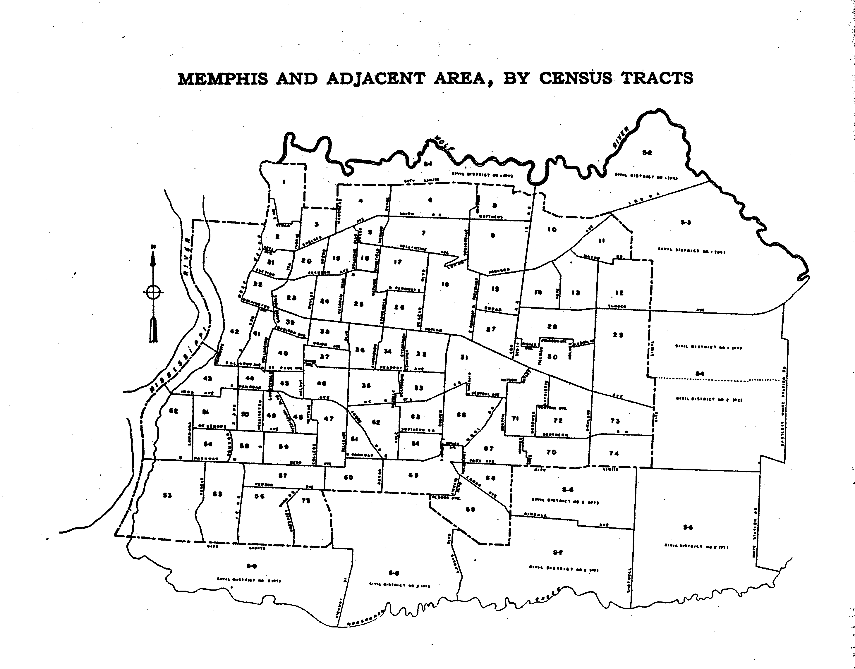
- Memphis
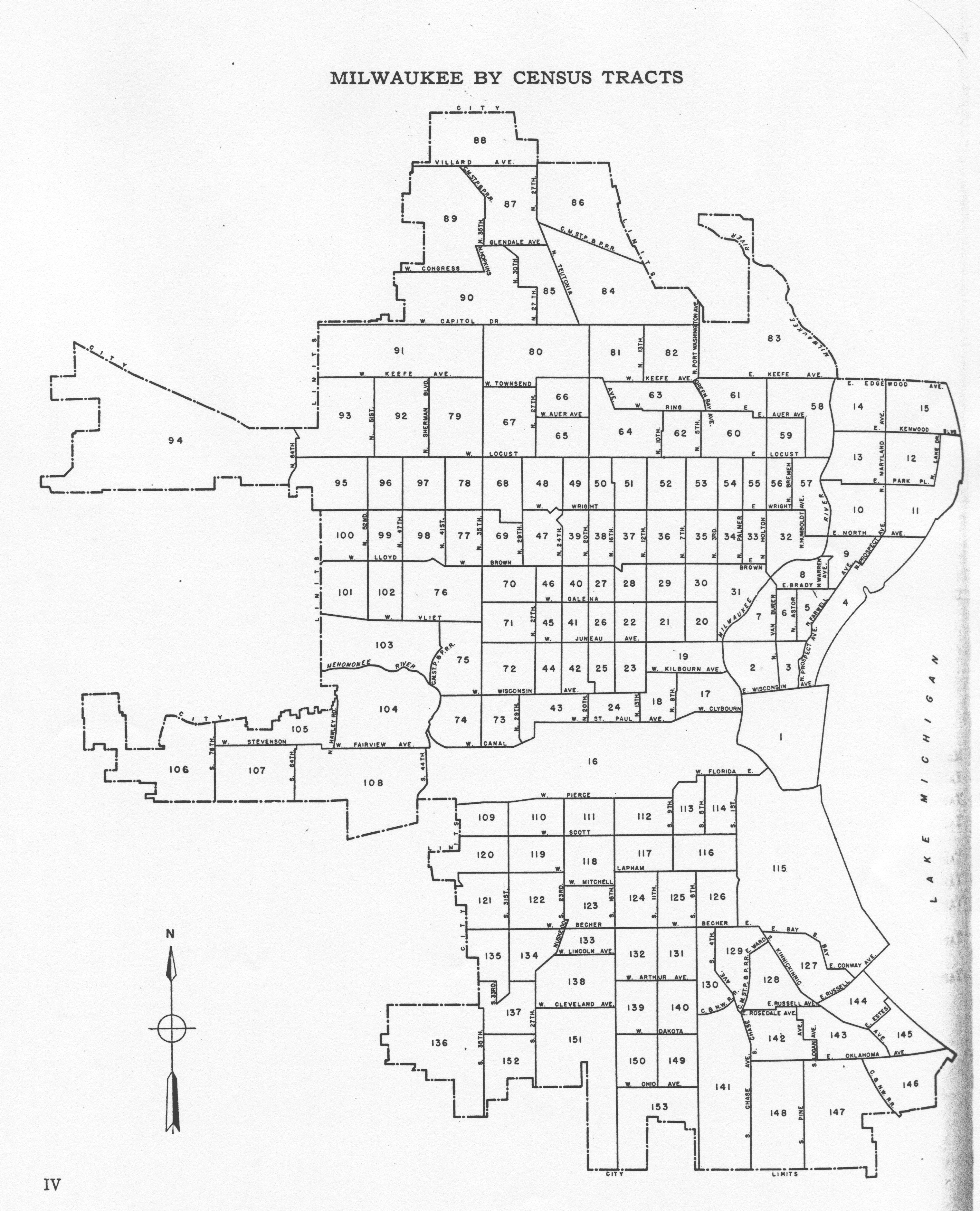
- Milwaukee
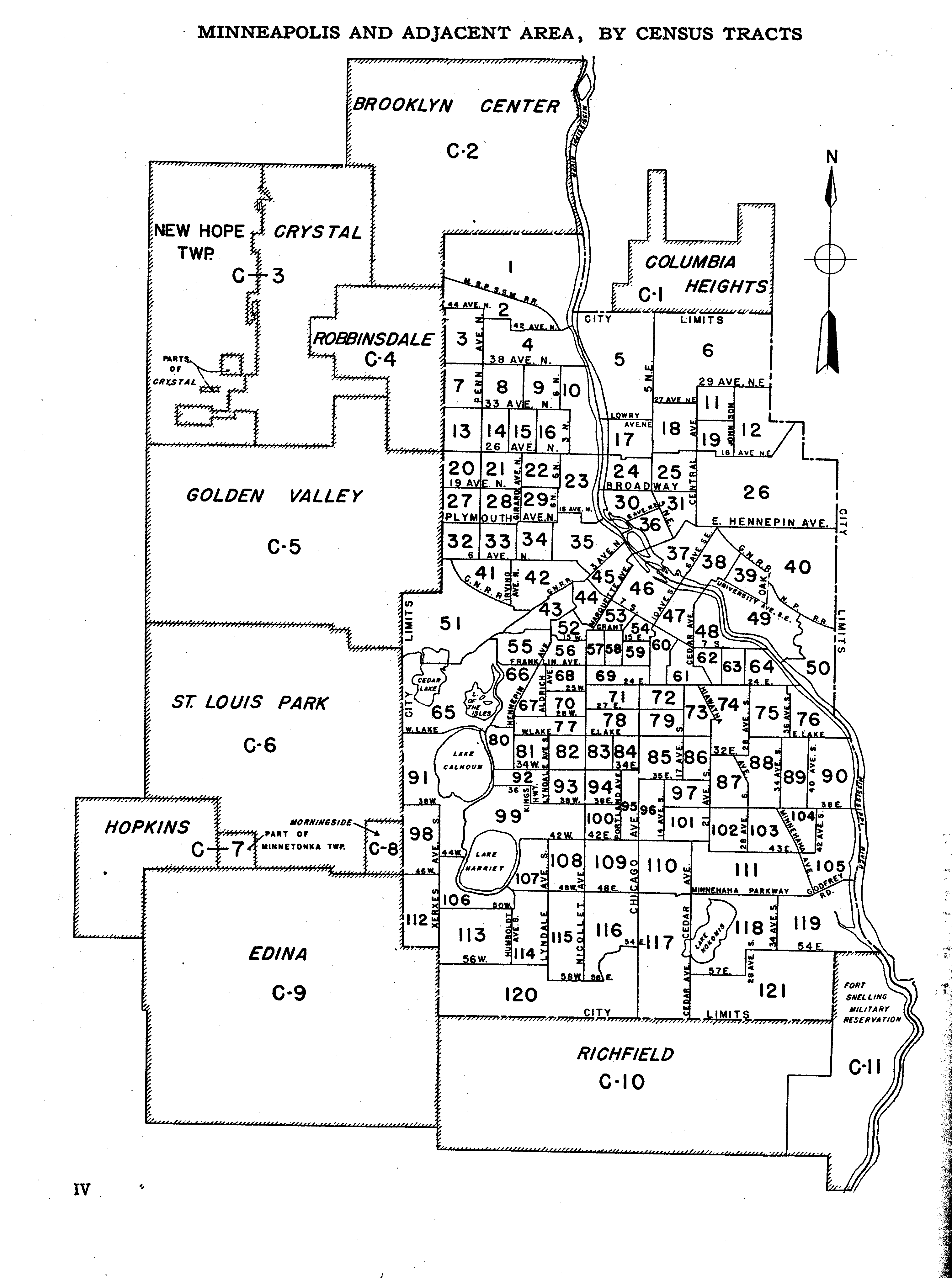
- Minneapolis
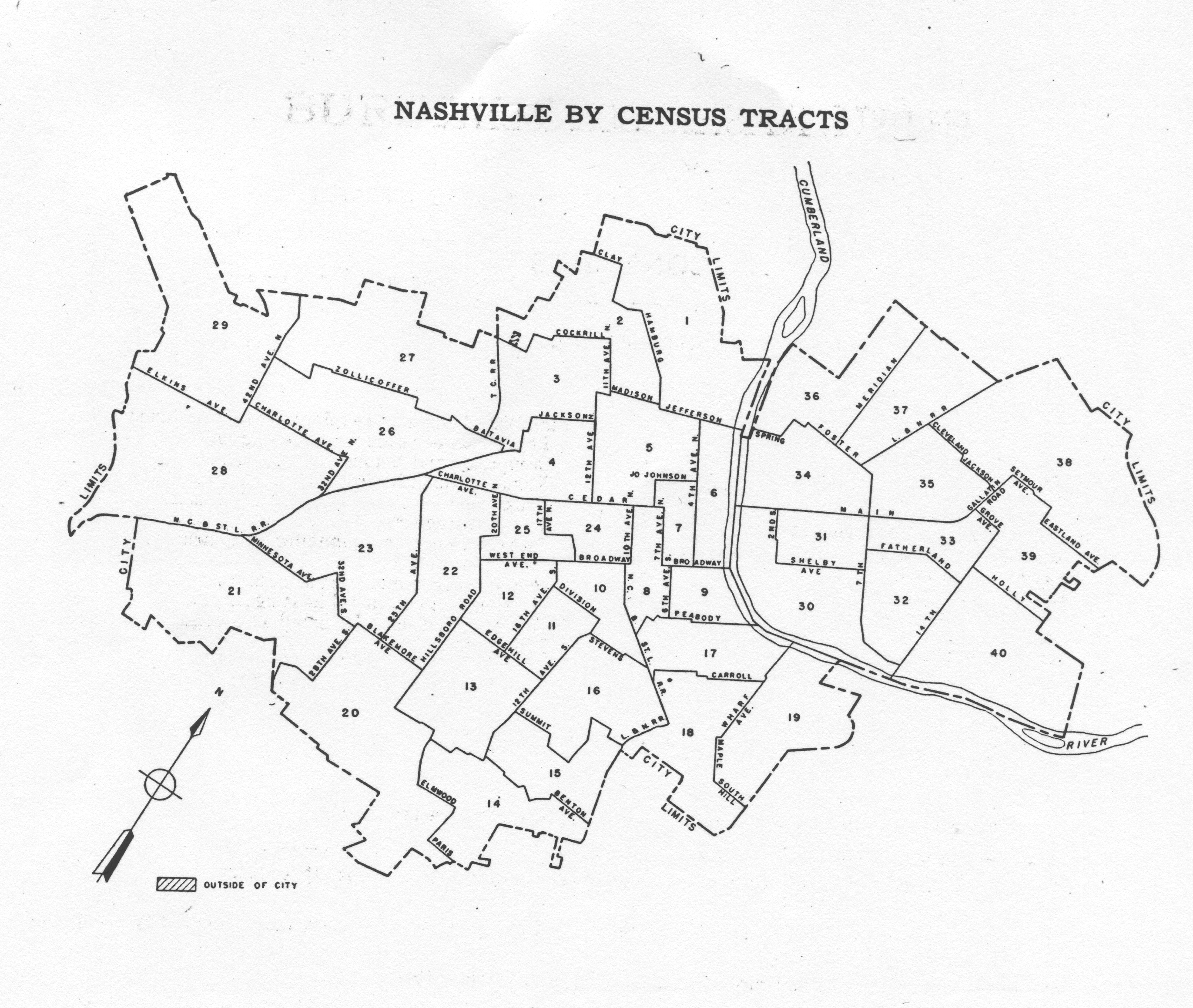
- Nashville
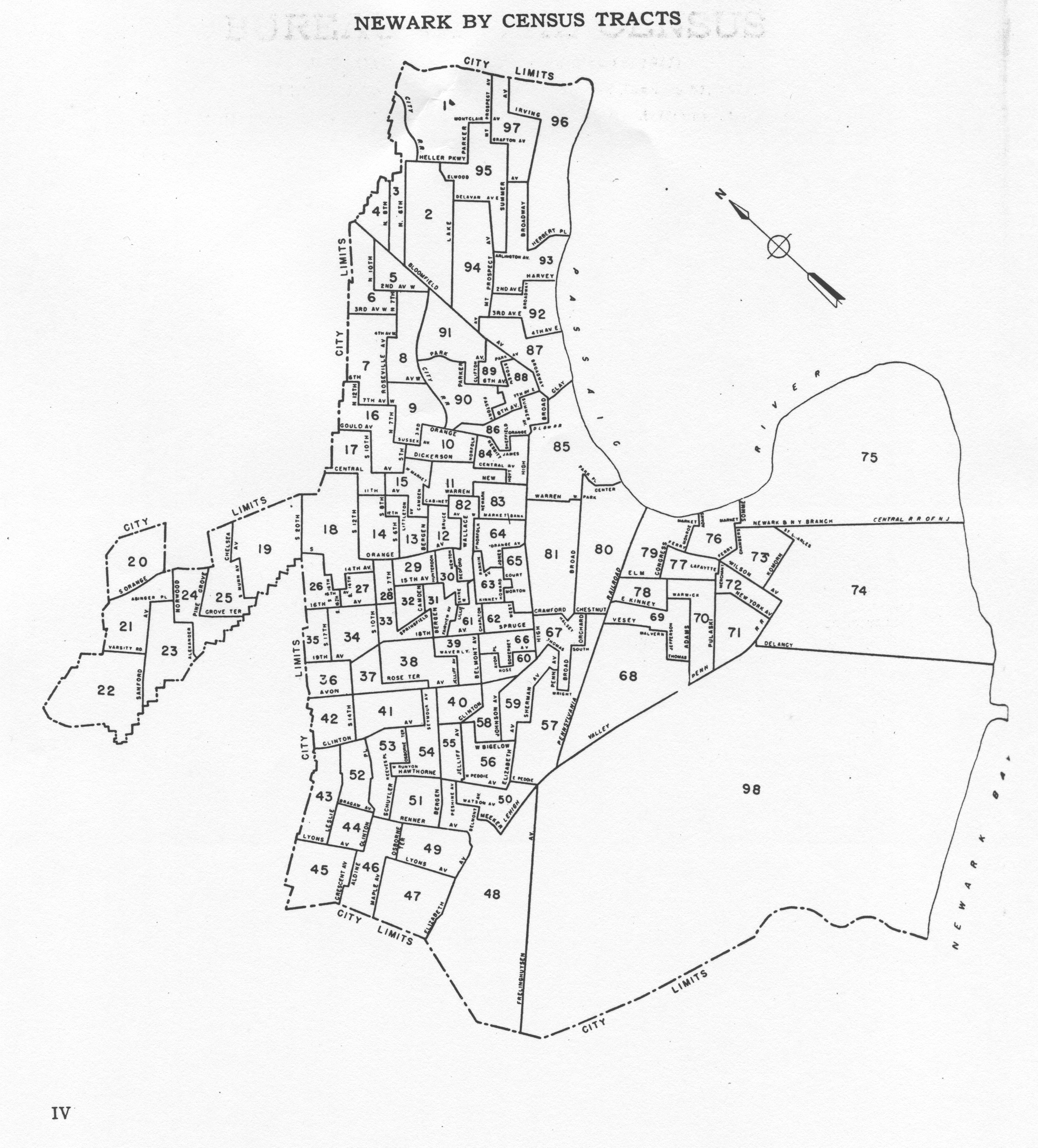
- Newark
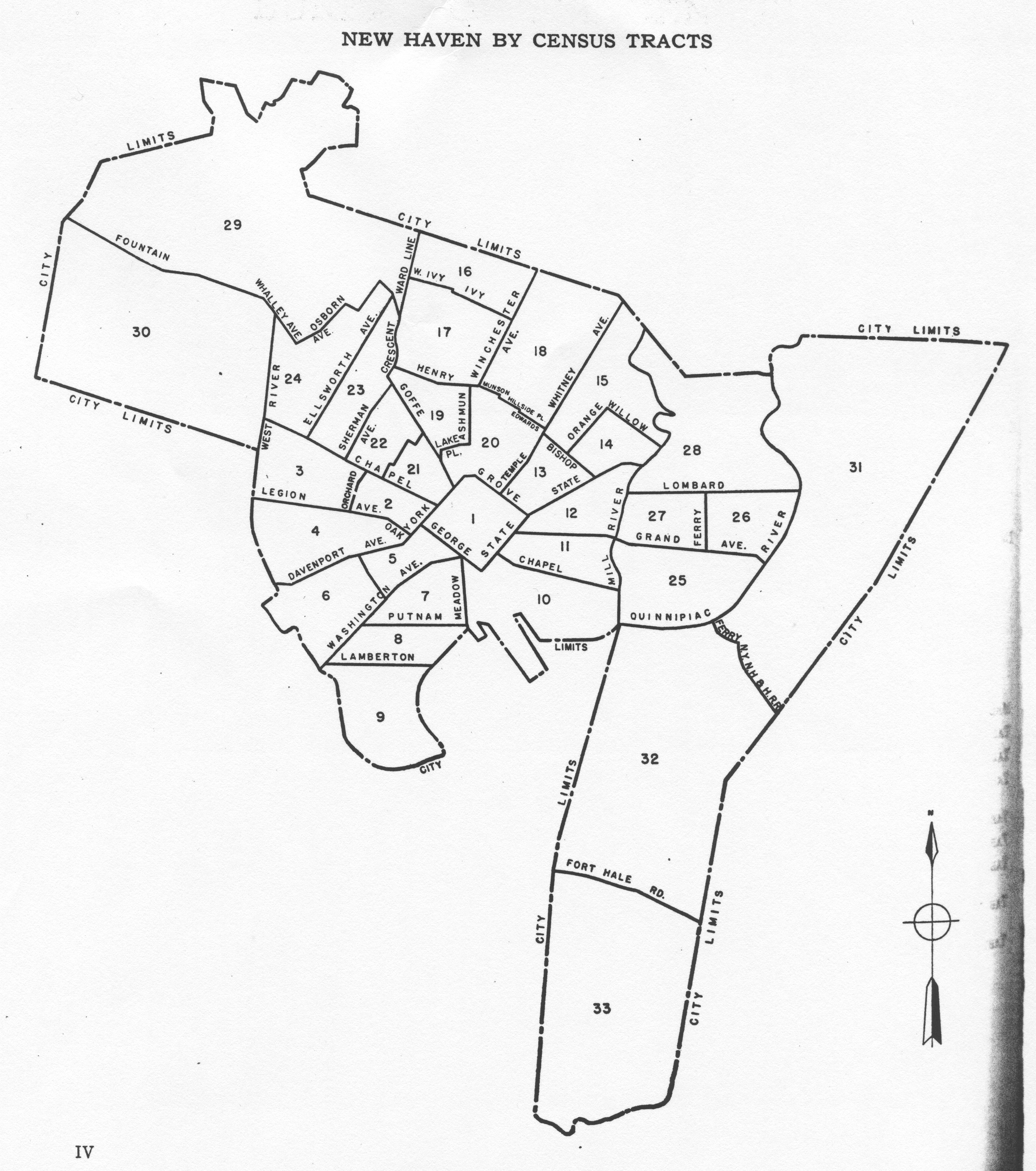
- New Haven
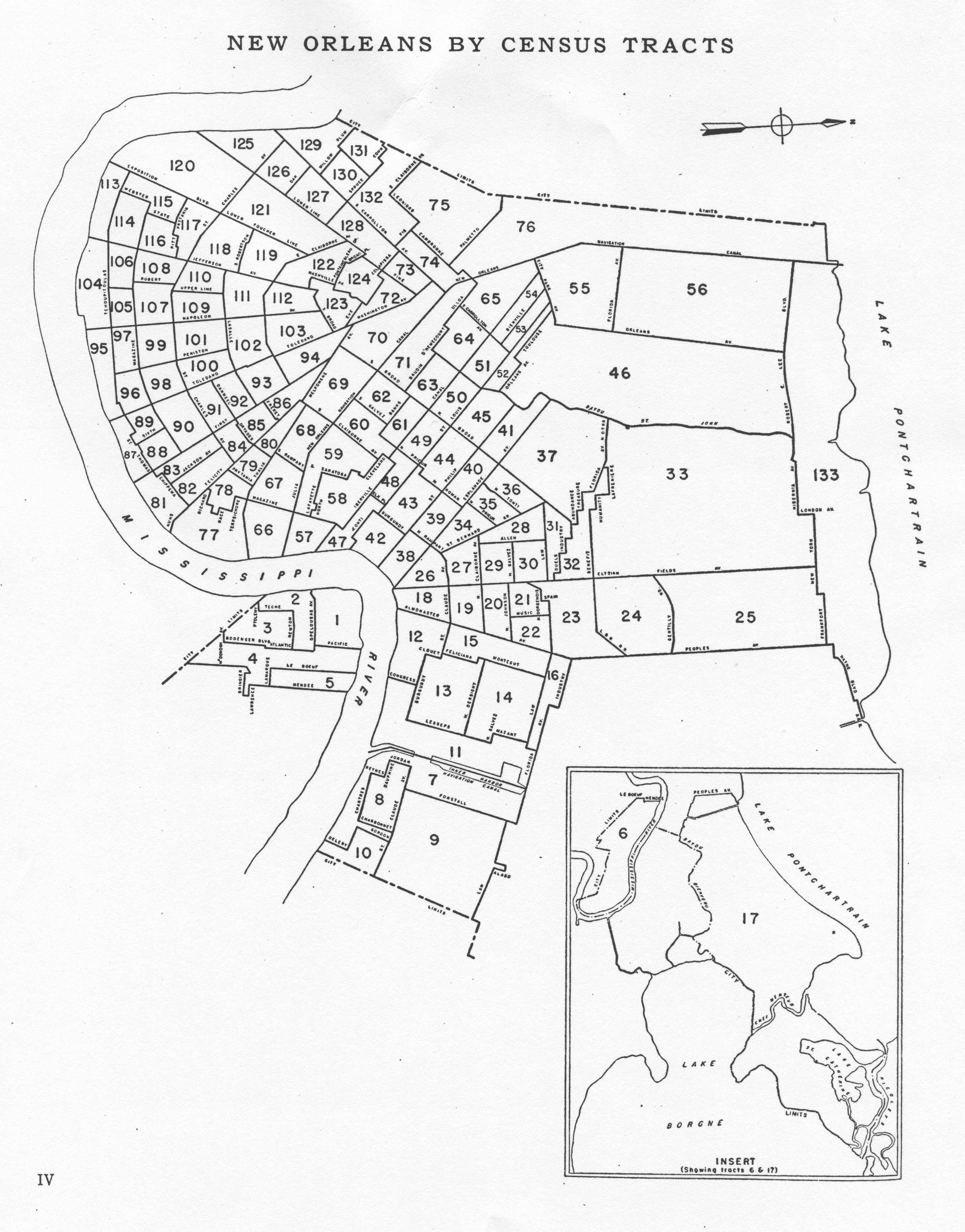
- New Orleans
- New York, NY (see below)
- Oakland-Berkeley
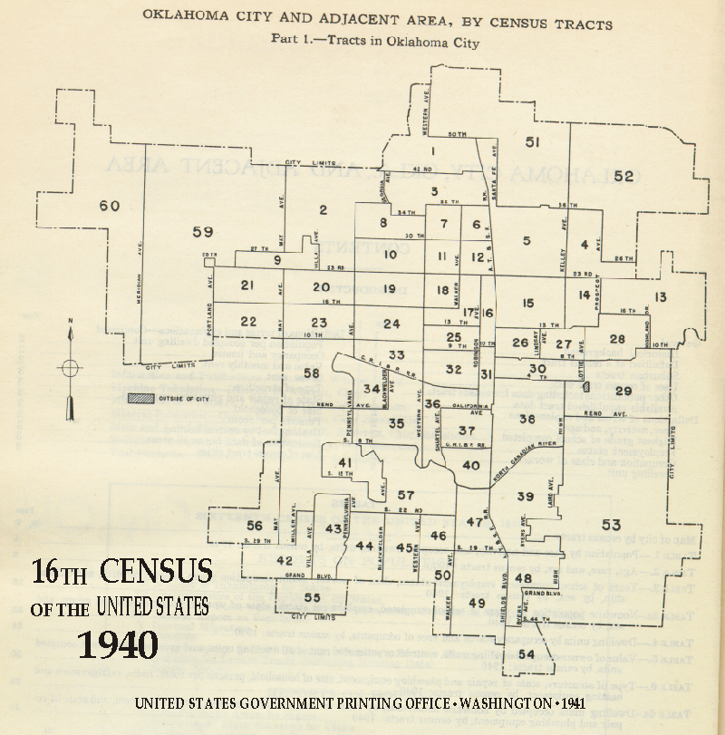
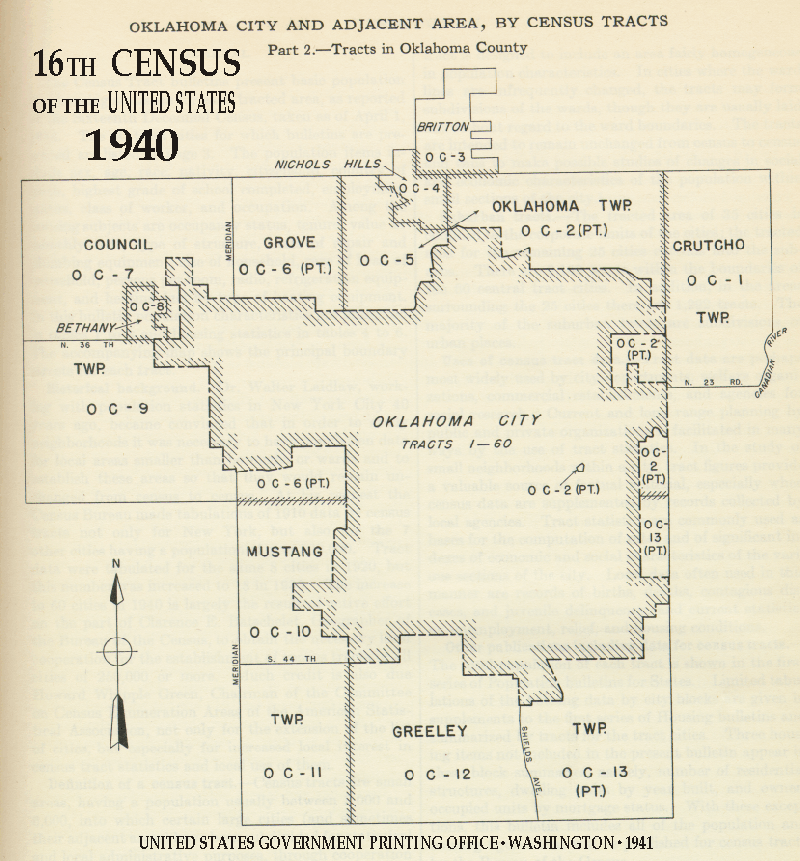
- Oklahoma City
- Oklahoma City Area
- Paterson
- Philadelphia 1
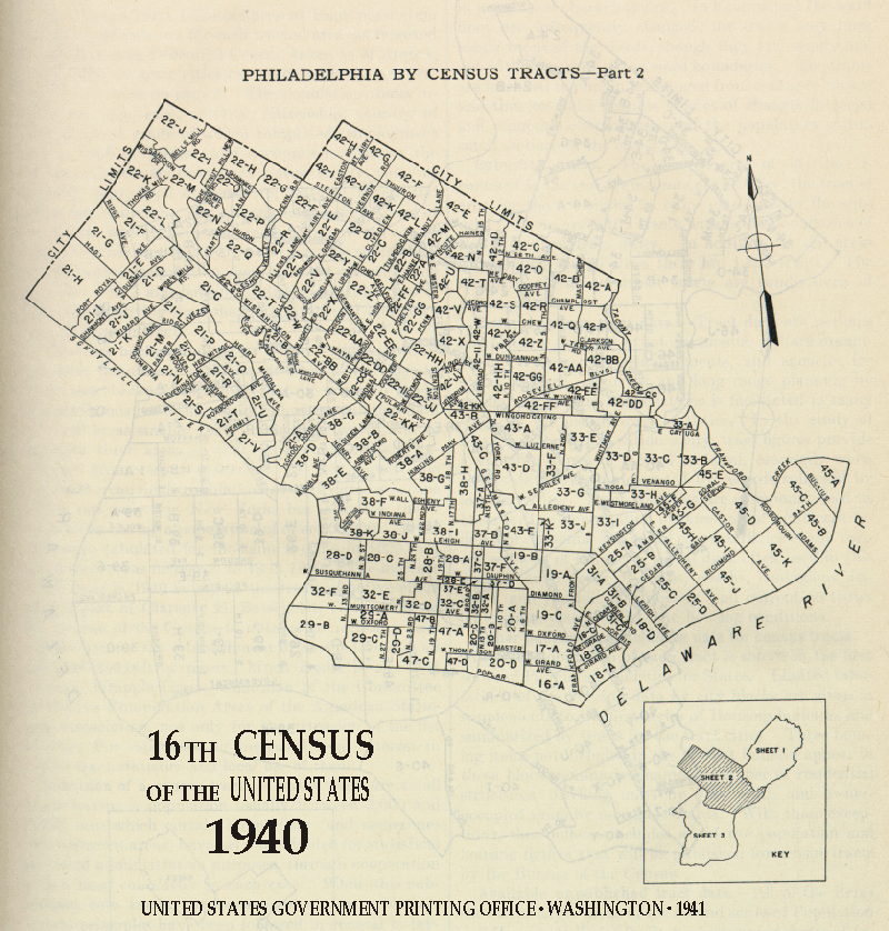
- Philadelphia 2
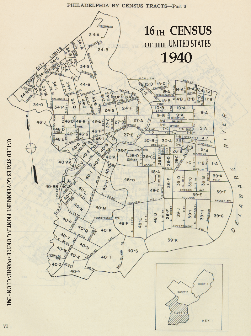
- Philadelphia 3
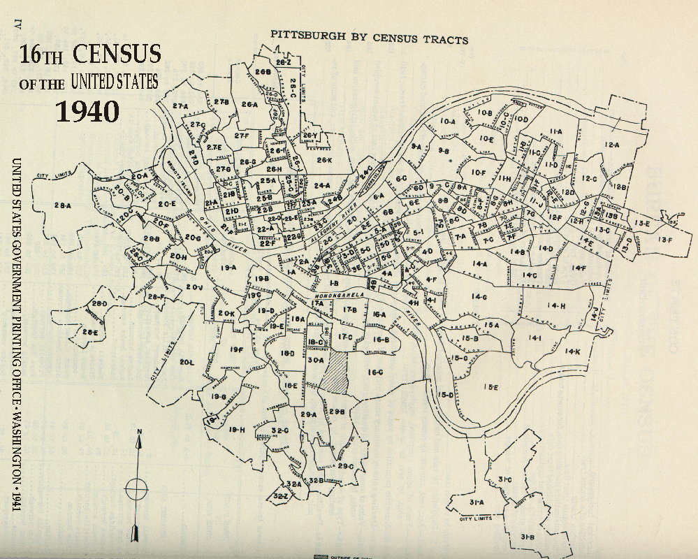
- Pittsburgh
- Pittsburgh Area 1
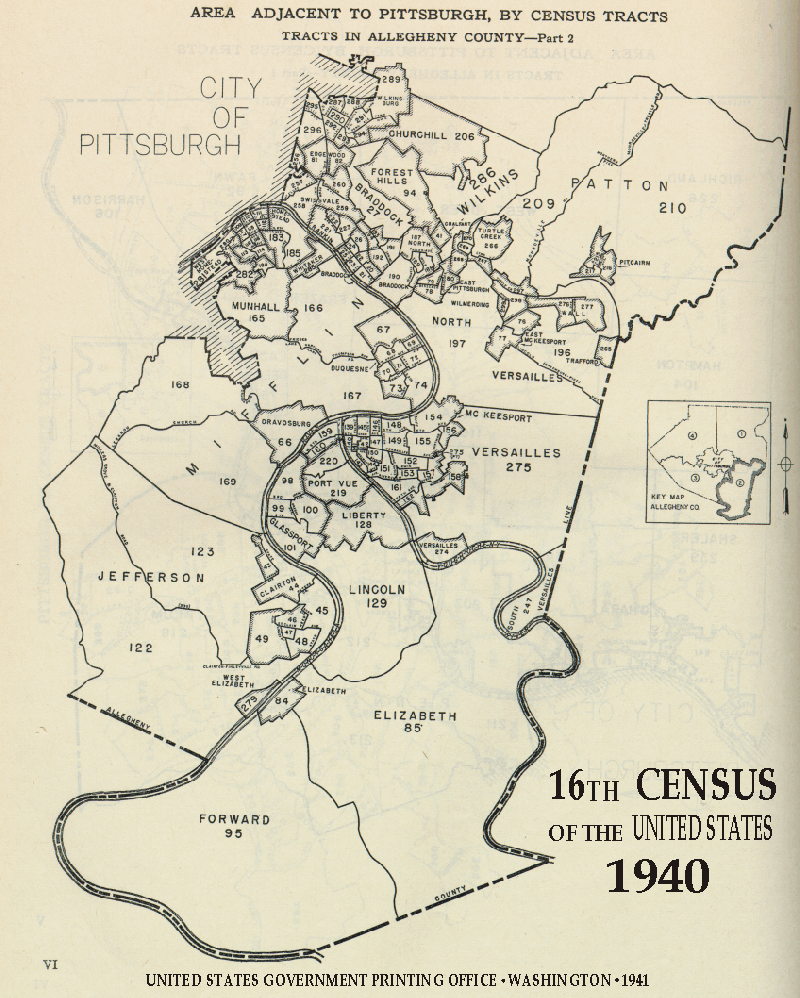
- Pittsburgh Area 2
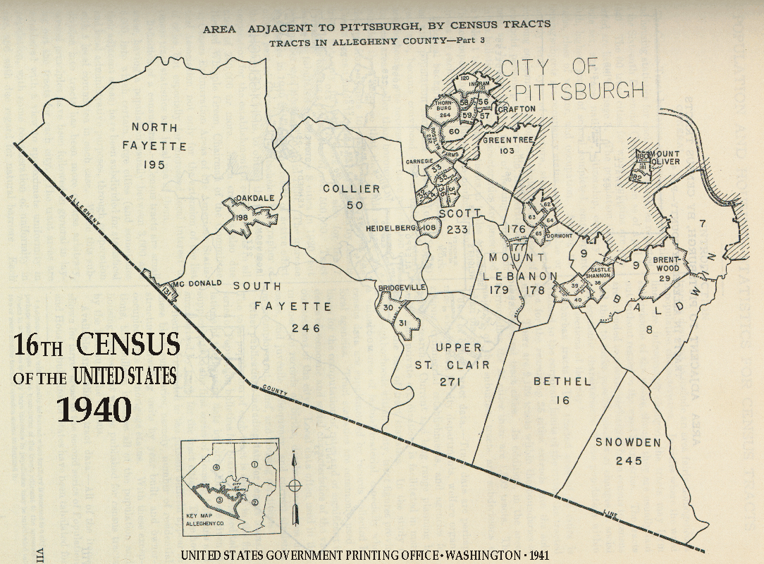
- Pittsburgh Area 3
- Pittsburgh Area 4
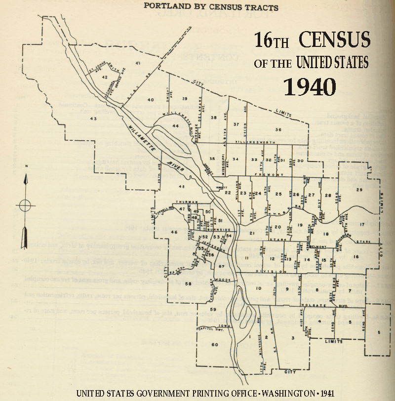
- Portland
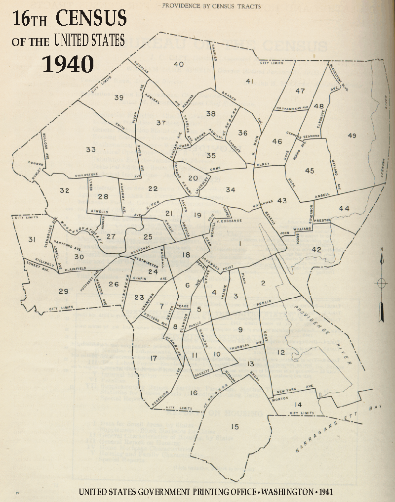
- Providence
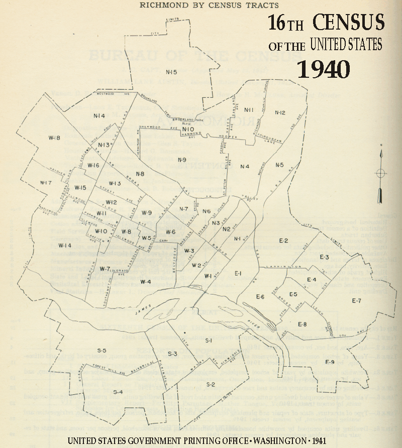
- Richmond
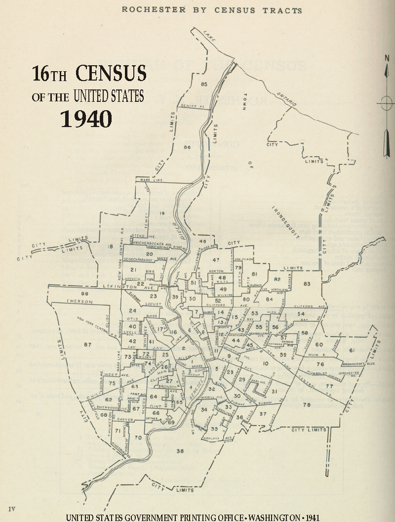
- Rochester
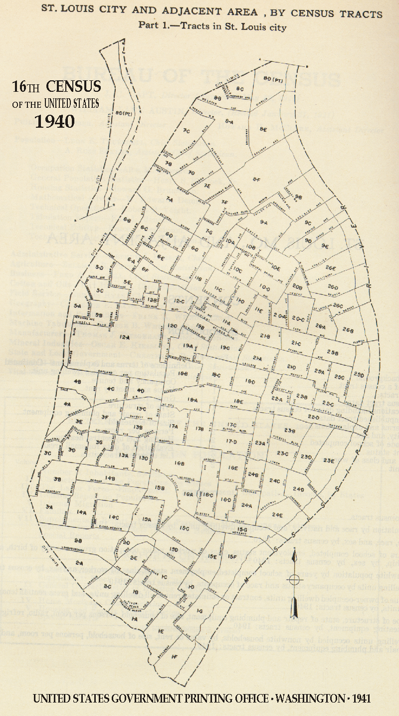
- St. Louis
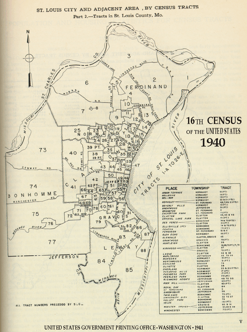
- St. Louis Area 1
- St. Louis Area 2
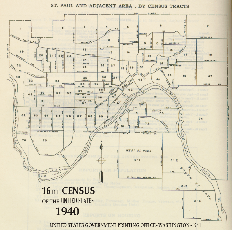
- St. Paul
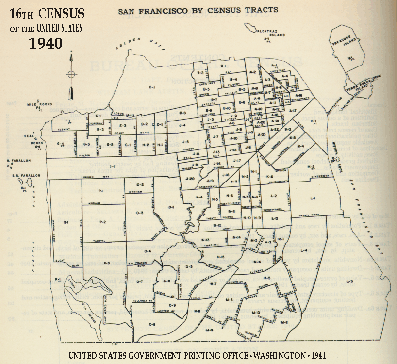
- San Francisco
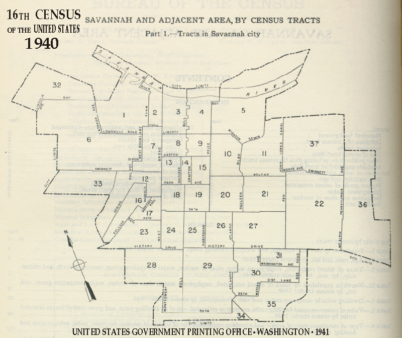
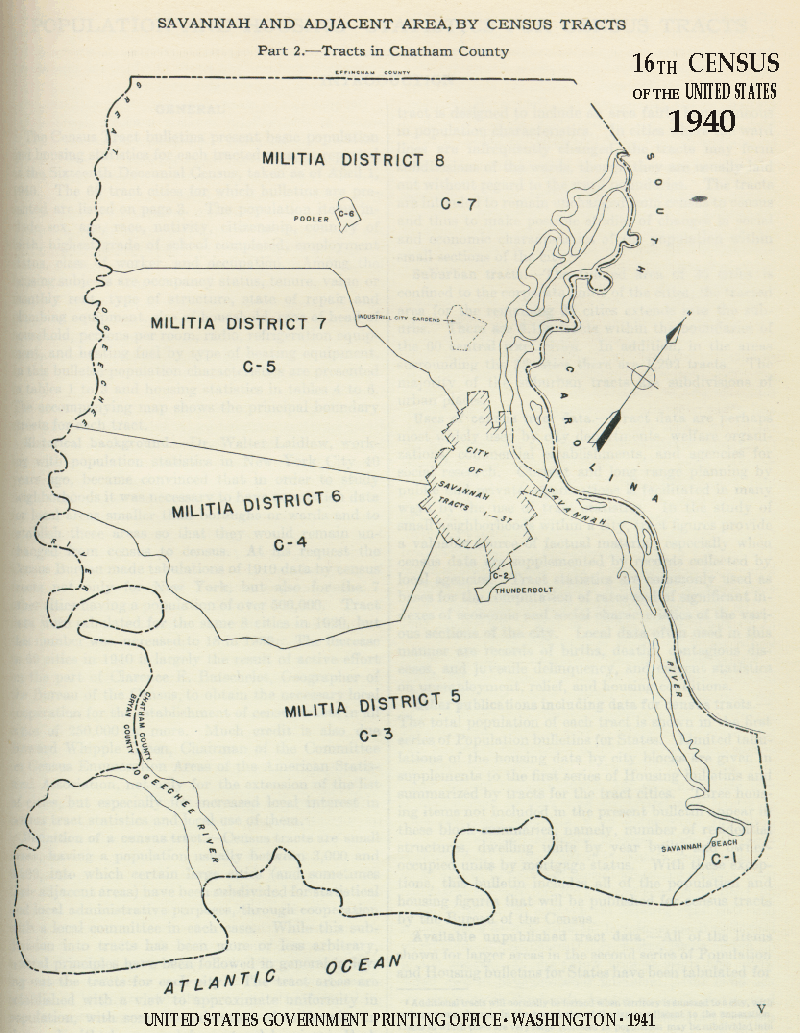
- Savannah
- Savannah Area
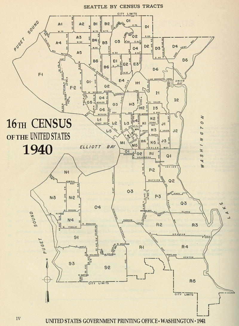
- Seattle
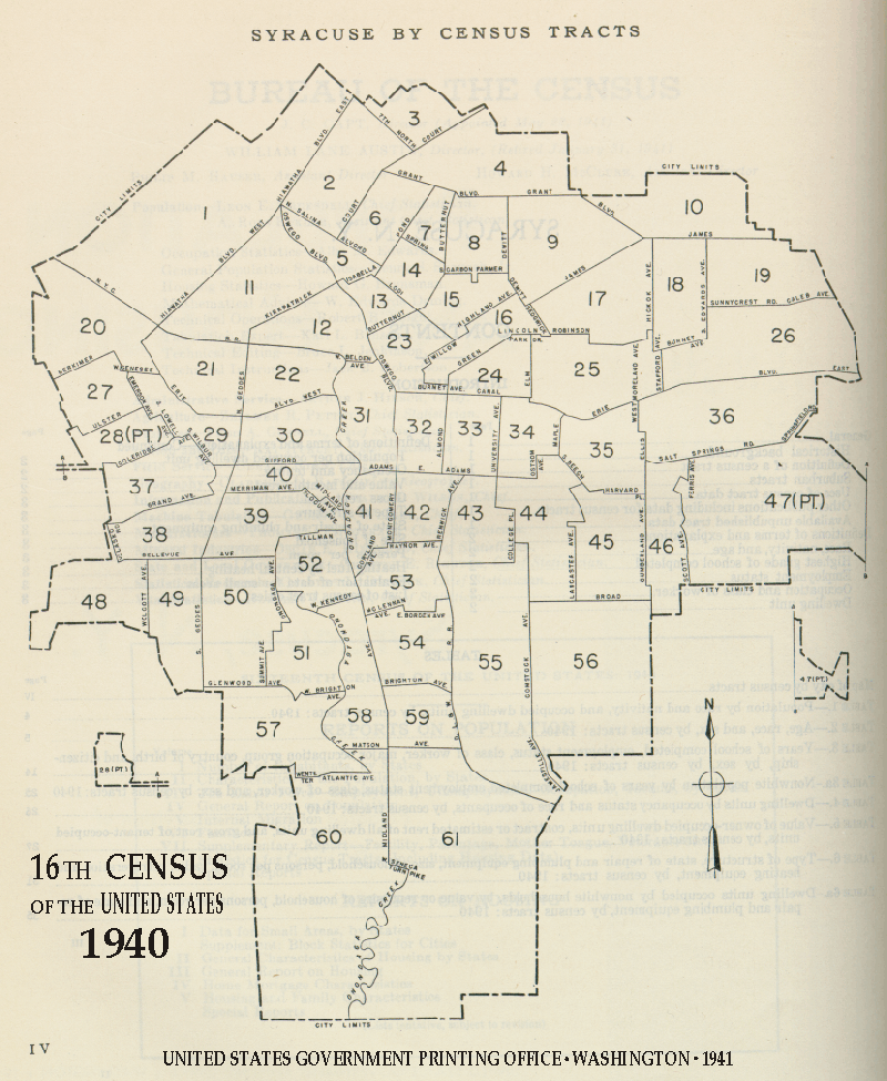
- Syracuse
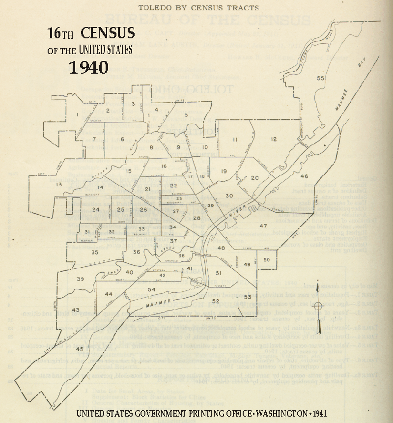
- Toledo
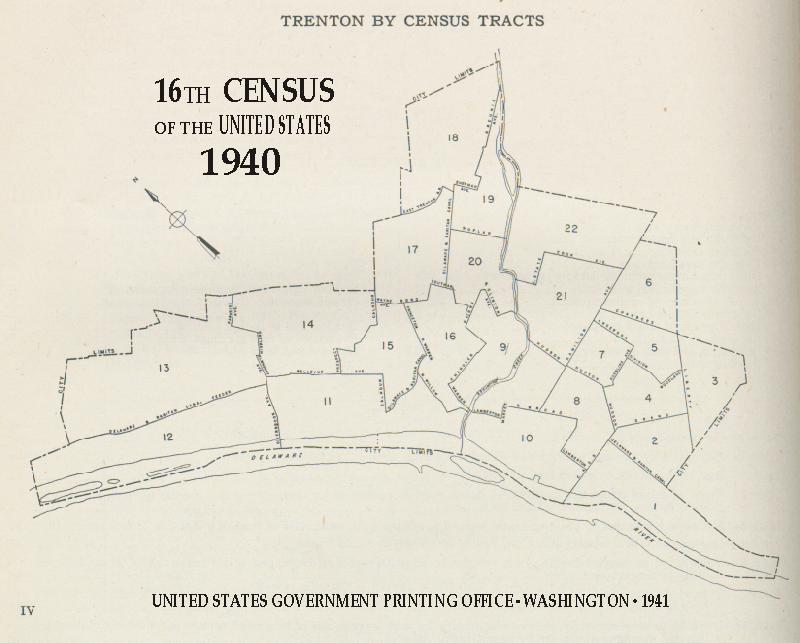
- Trenton
- Washington D.C.
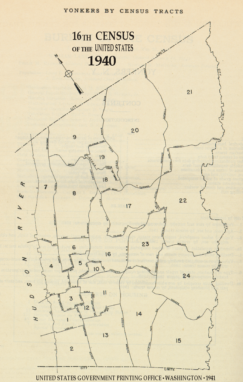
- Yonkers
New York
Population: Supplement to the First Series Bulletin for New York
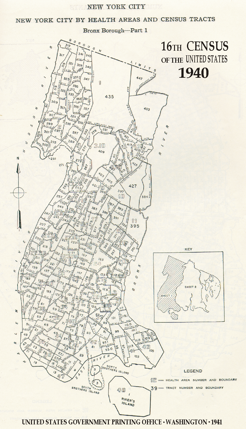
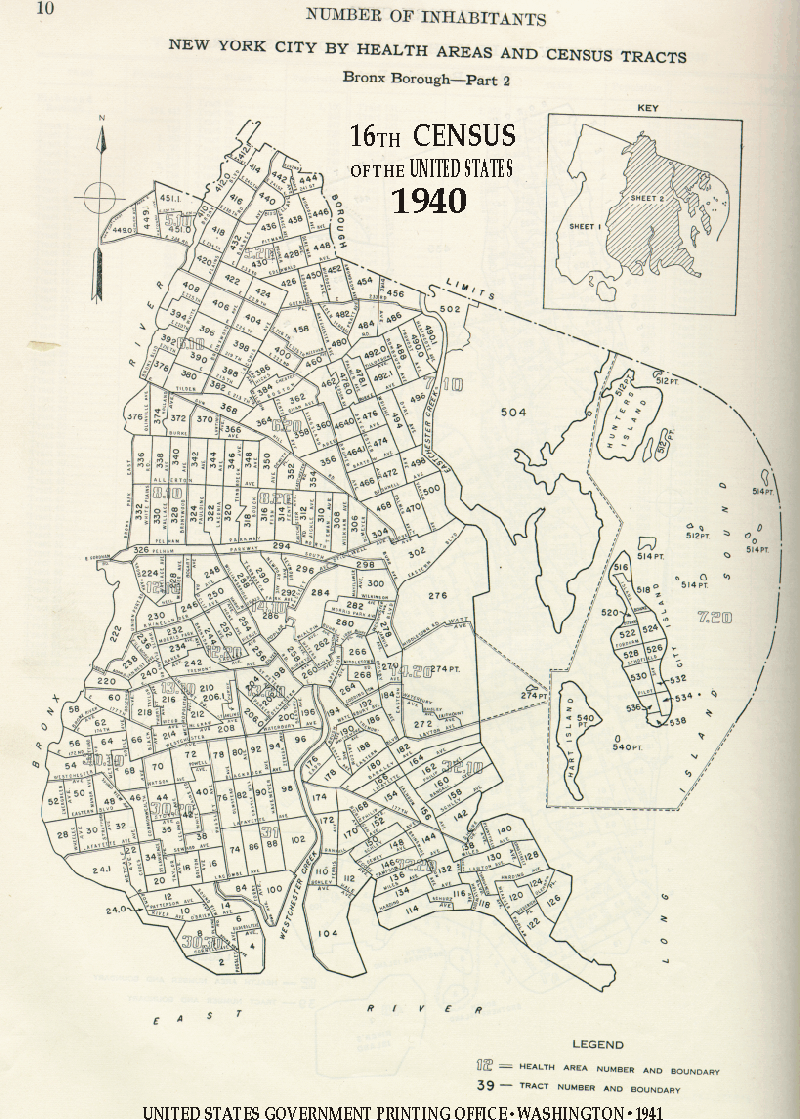
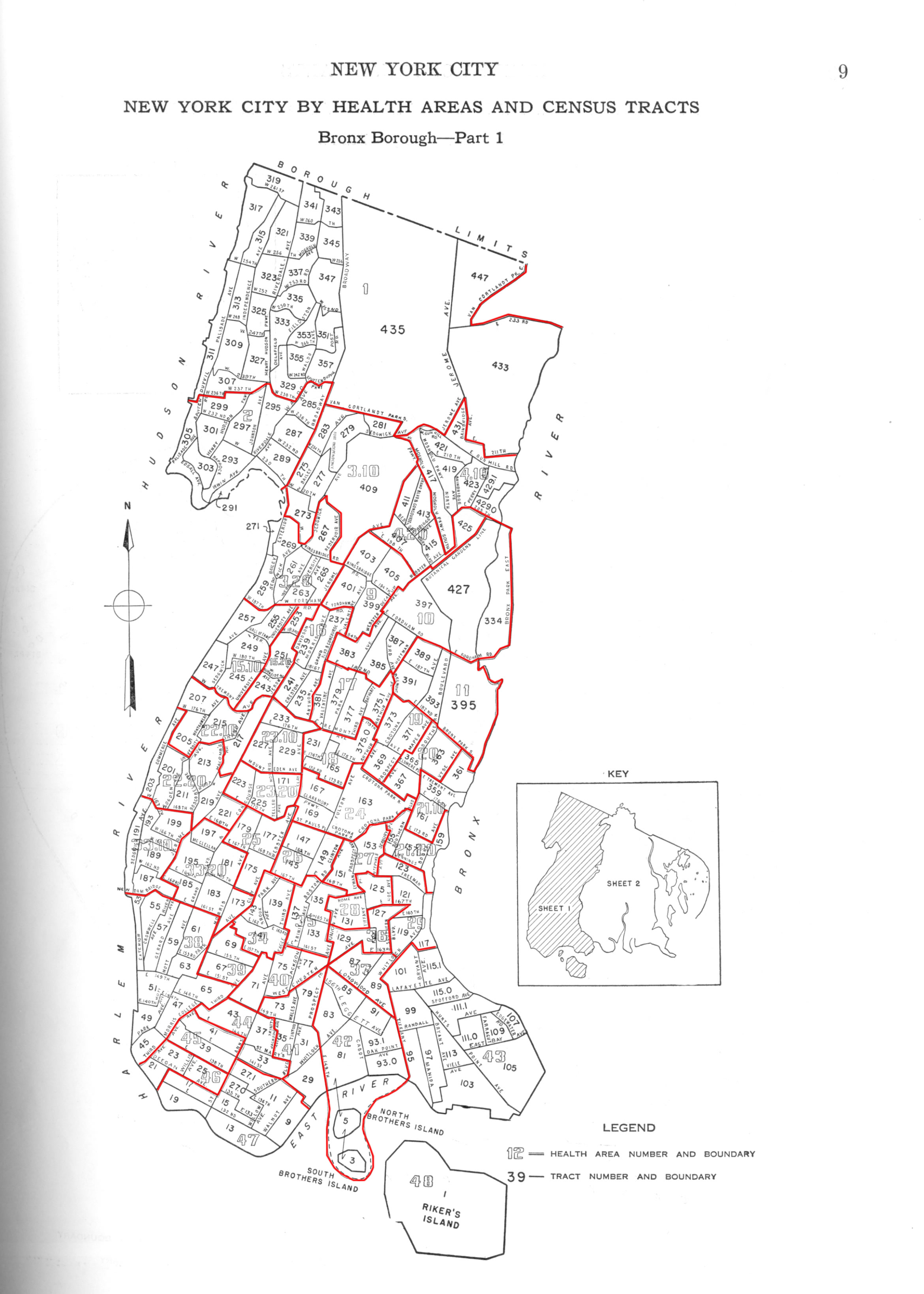
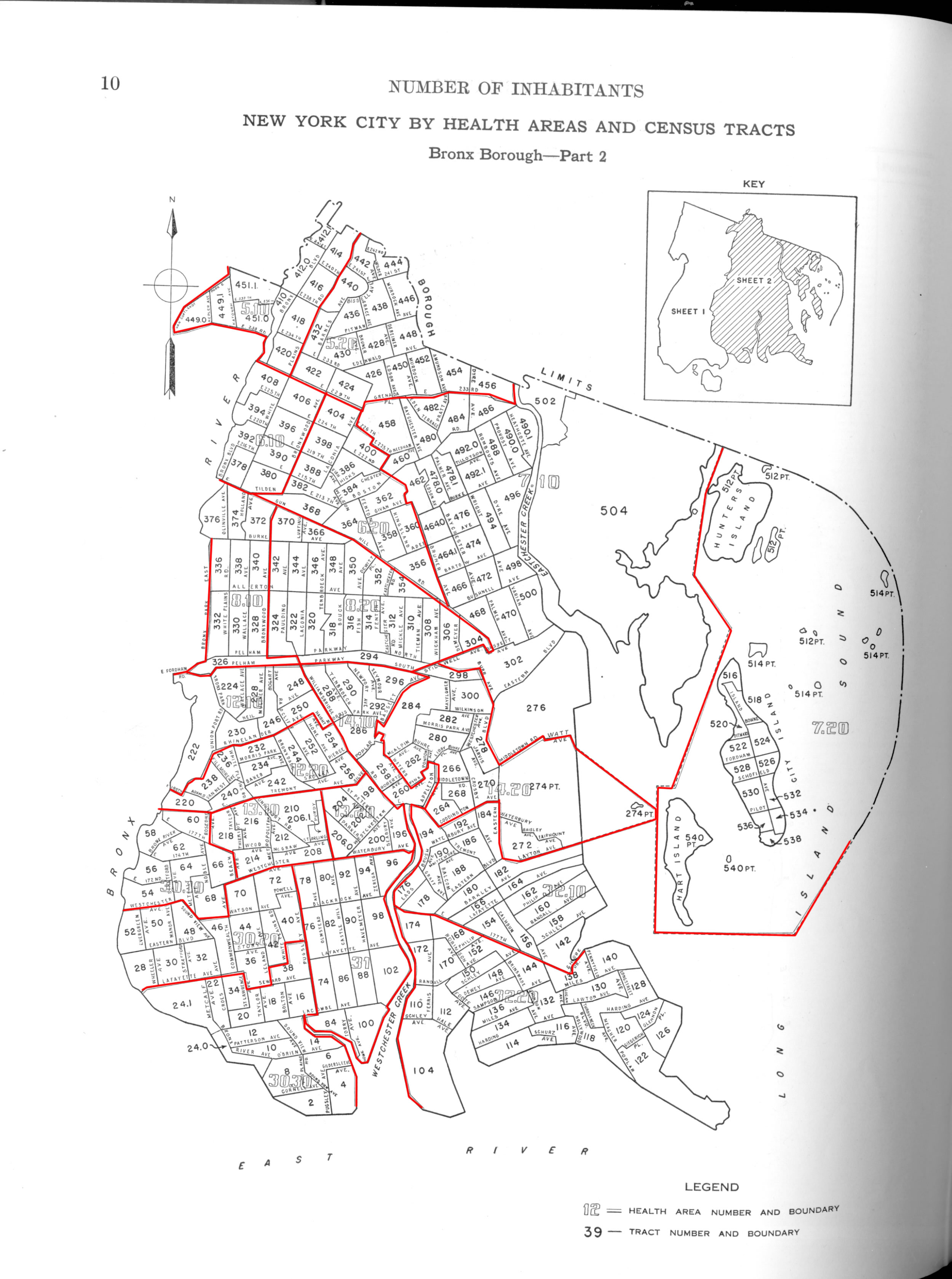
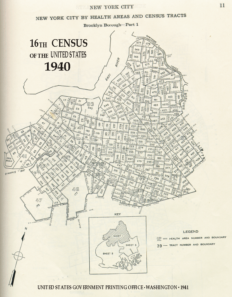
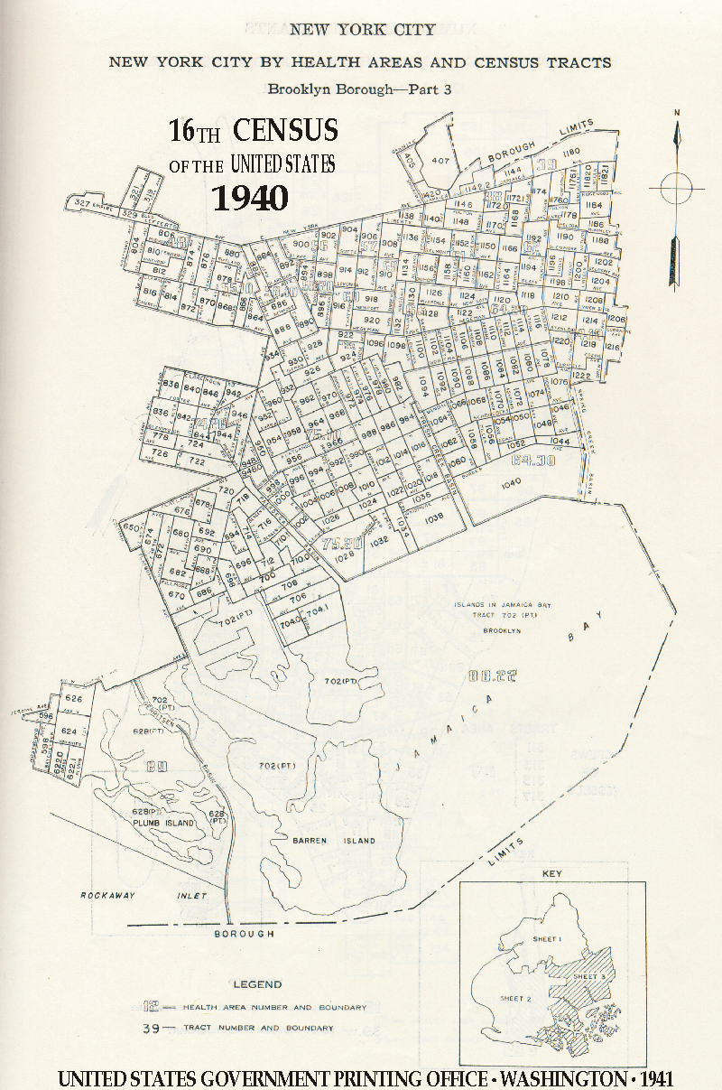
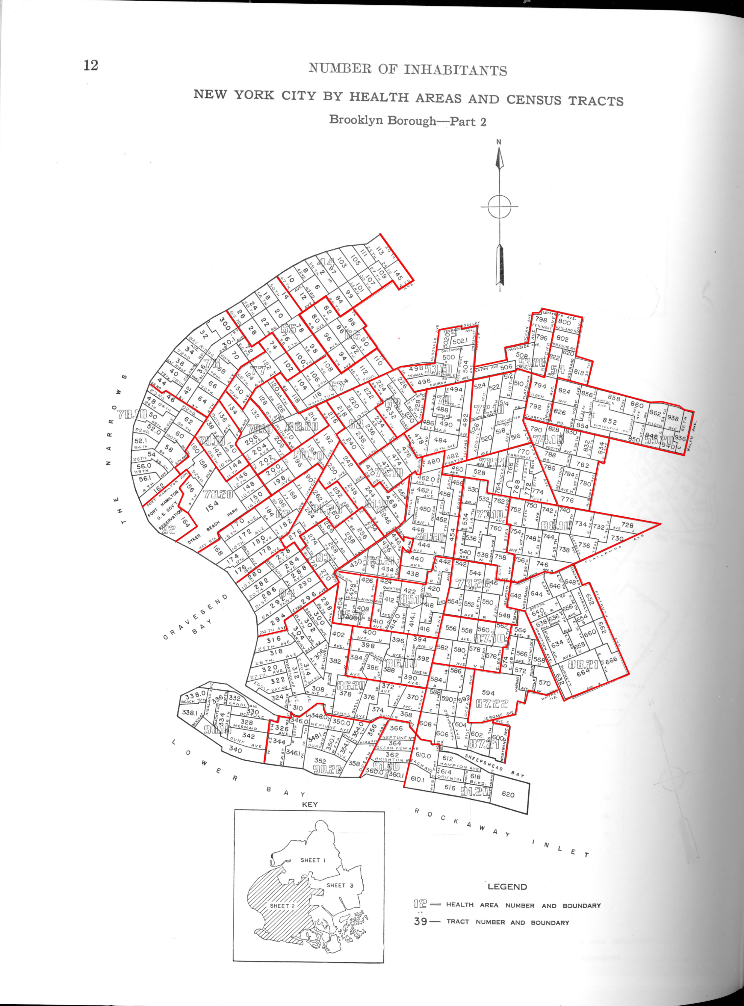
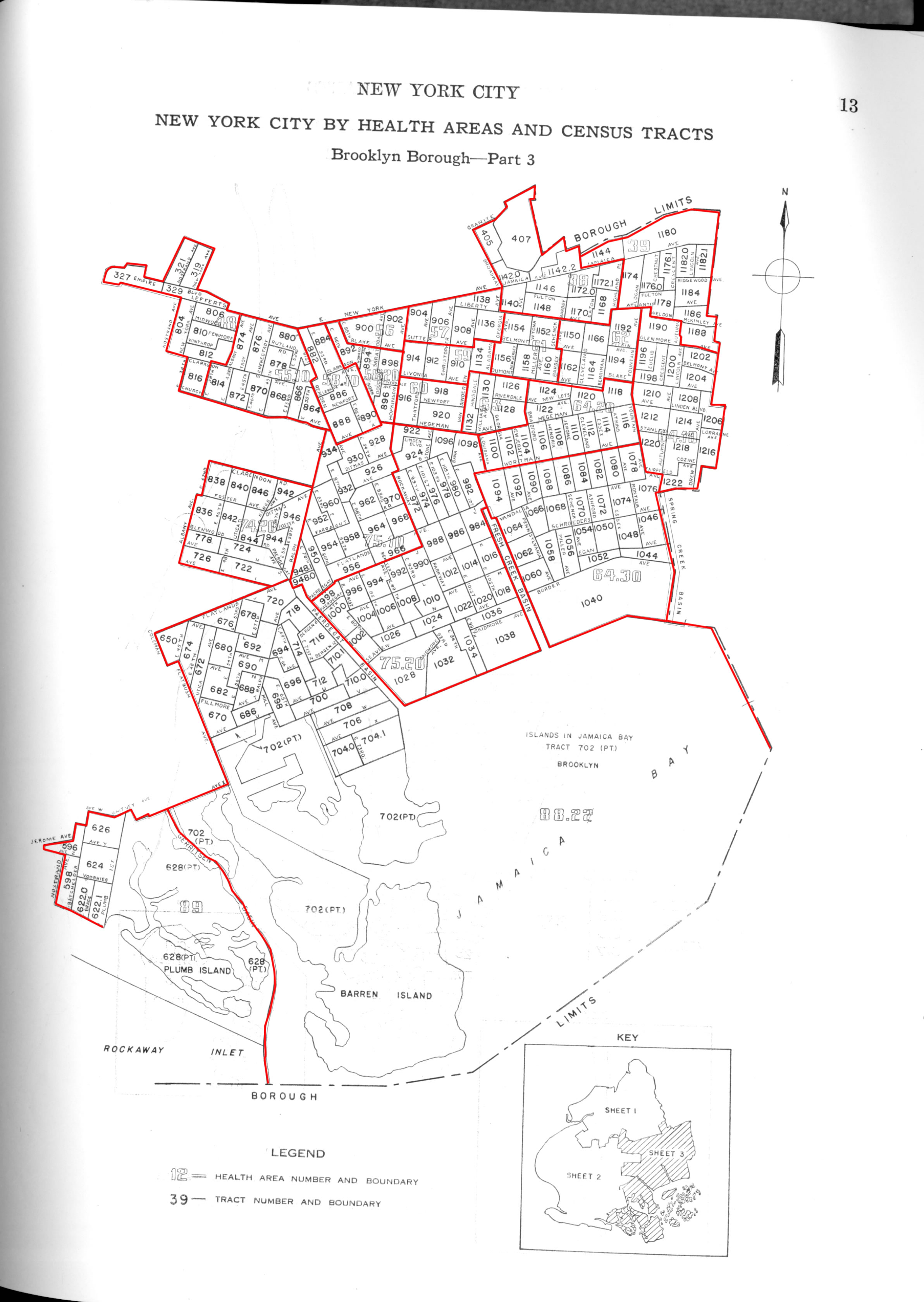
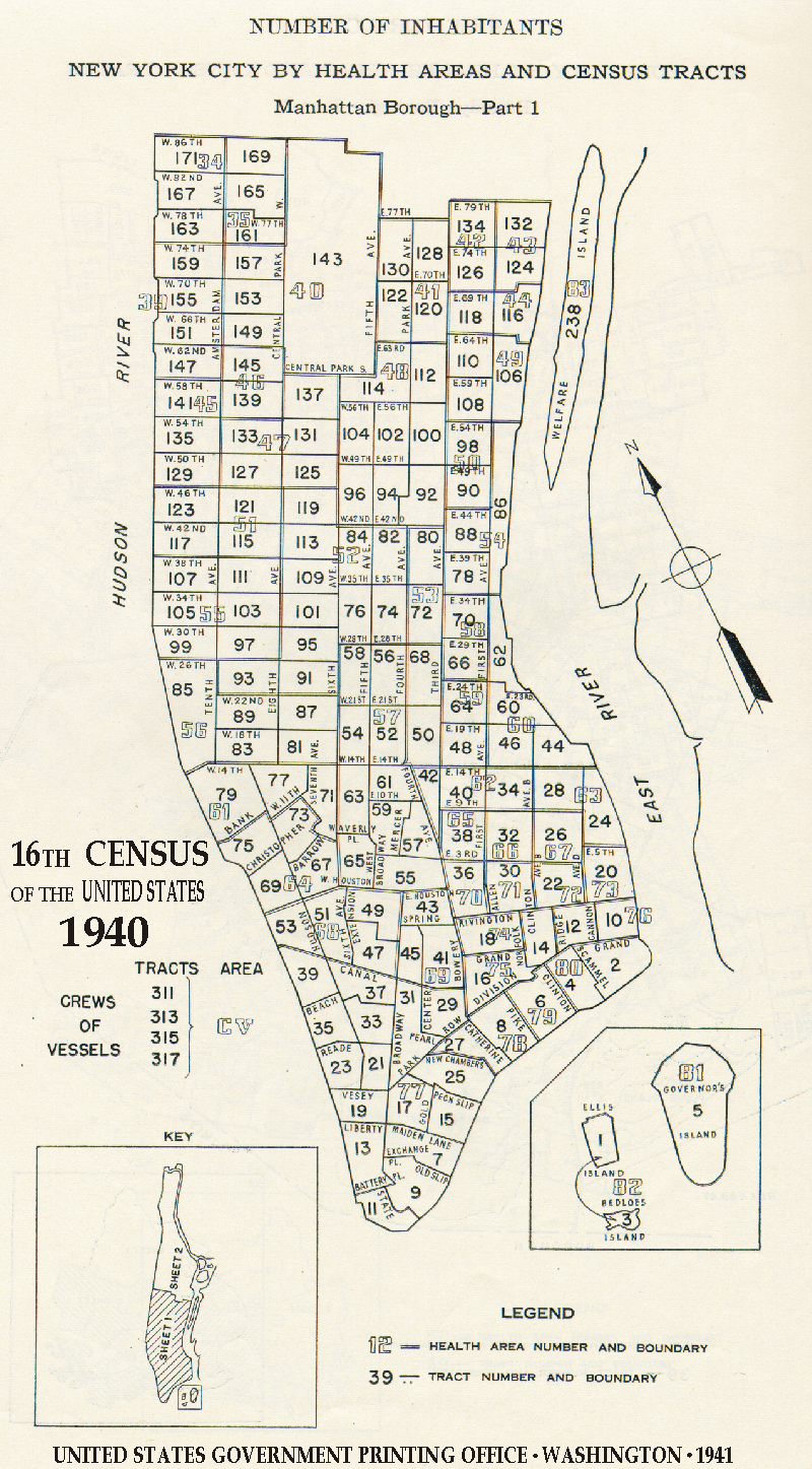
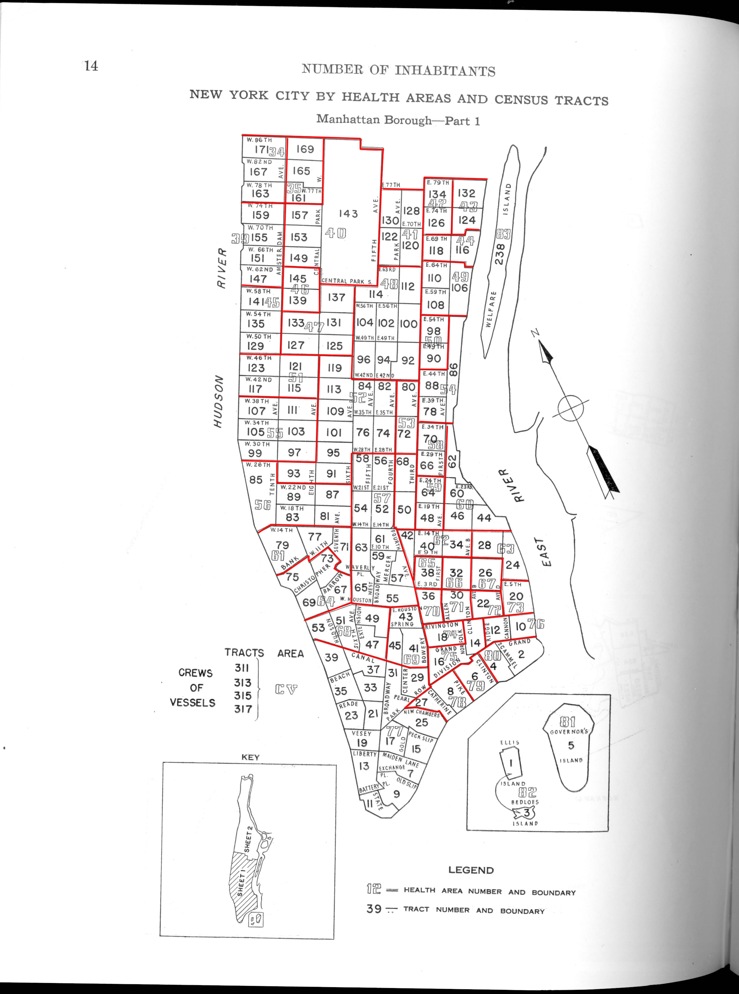
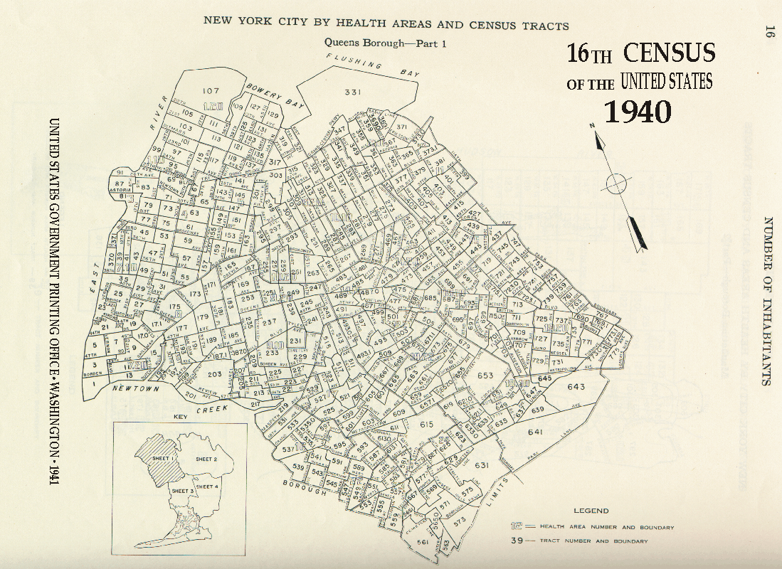
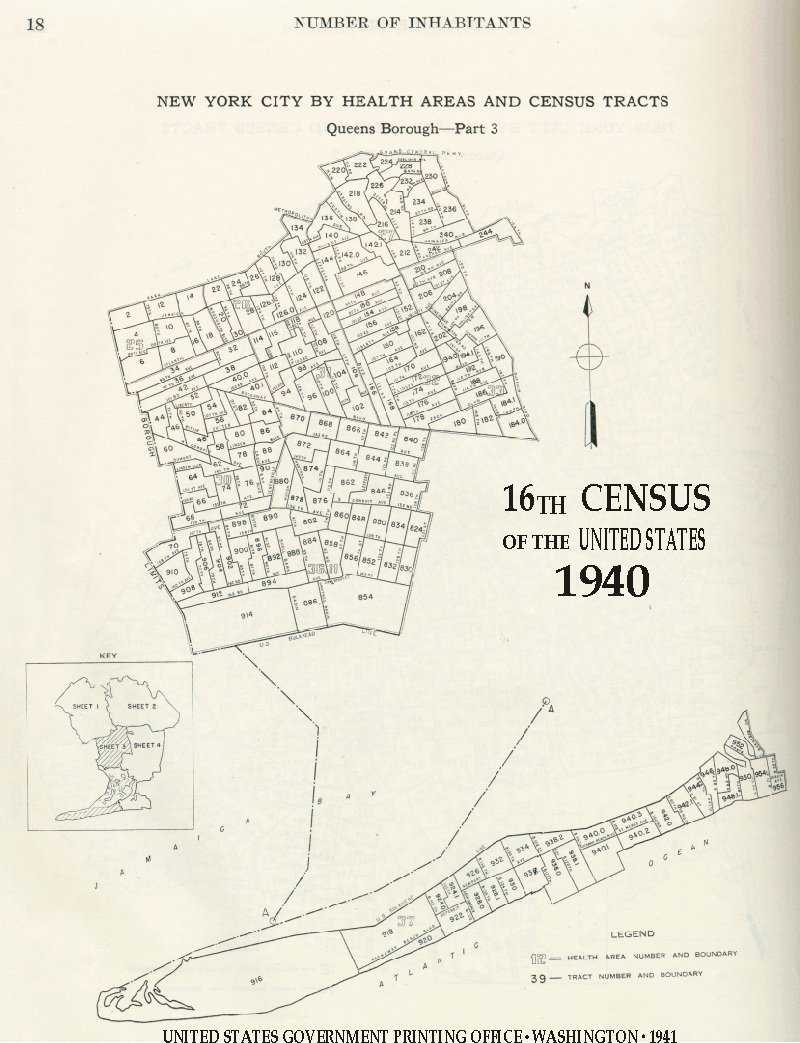
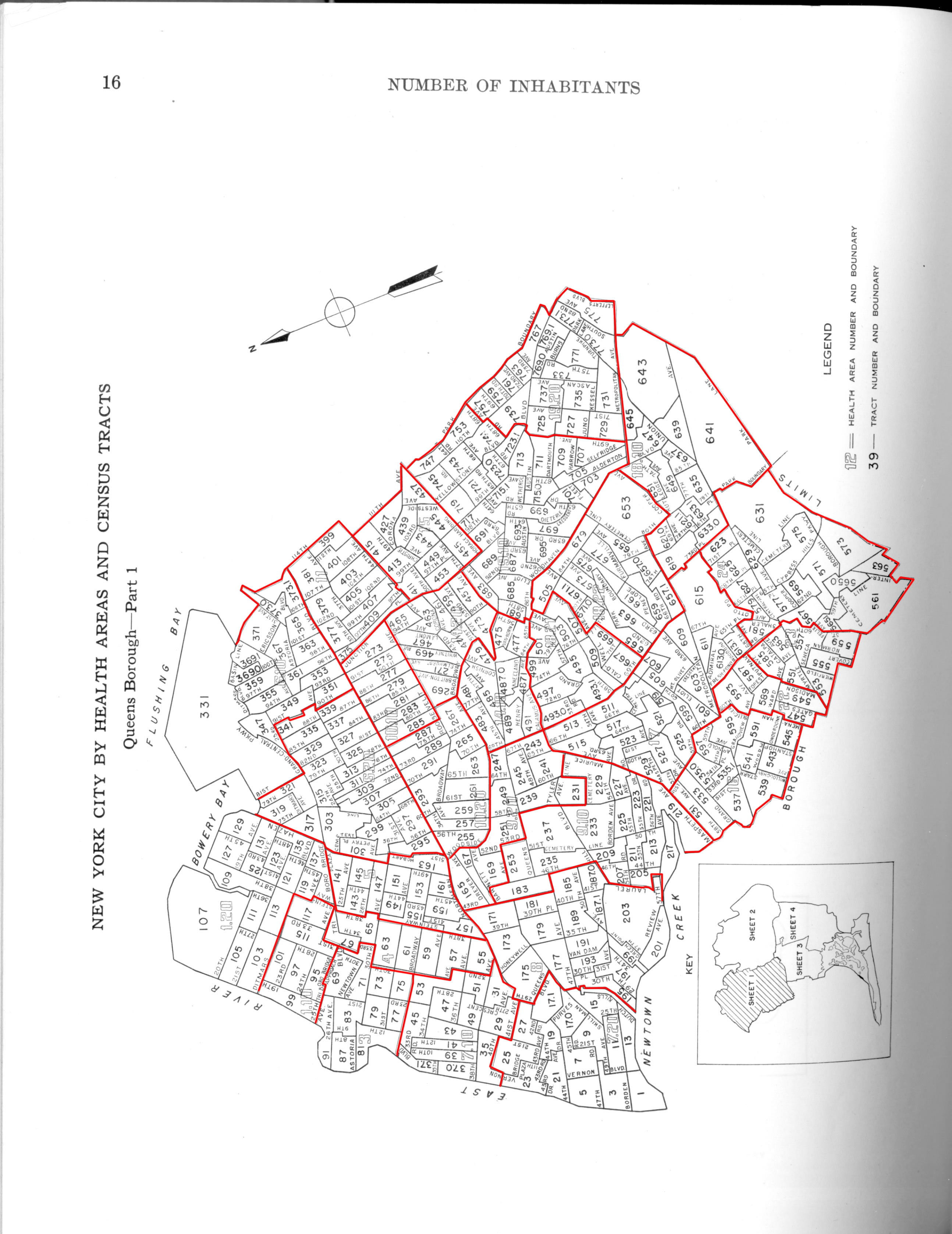
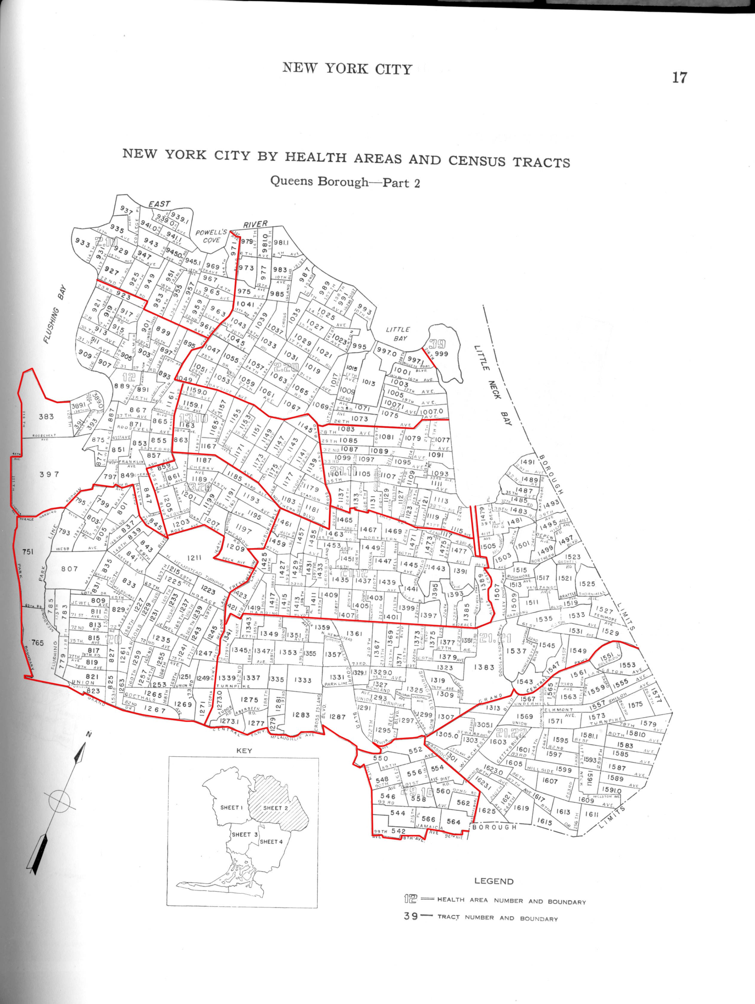
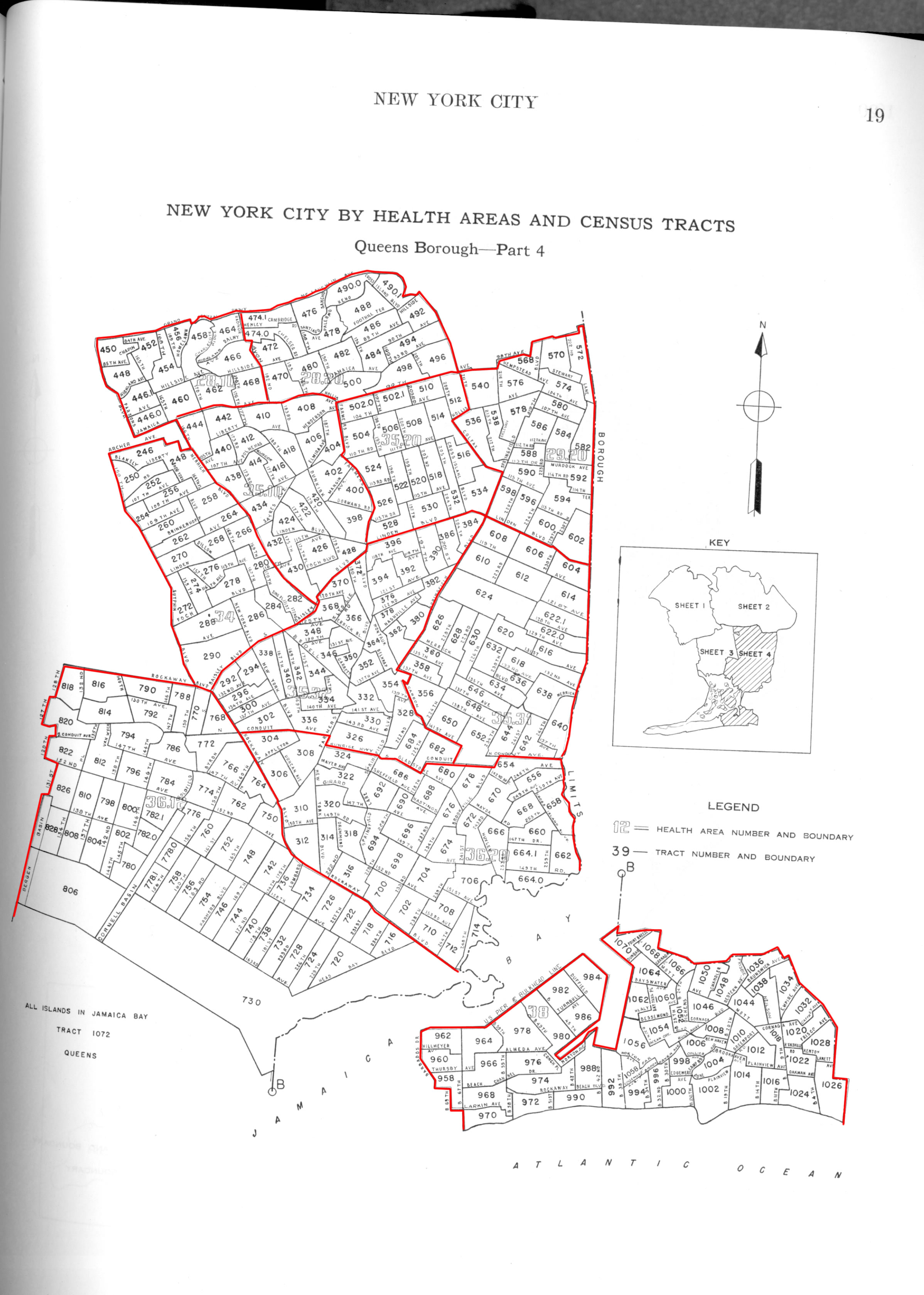
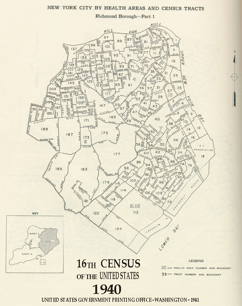
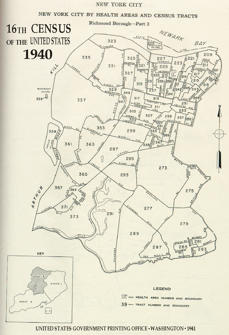
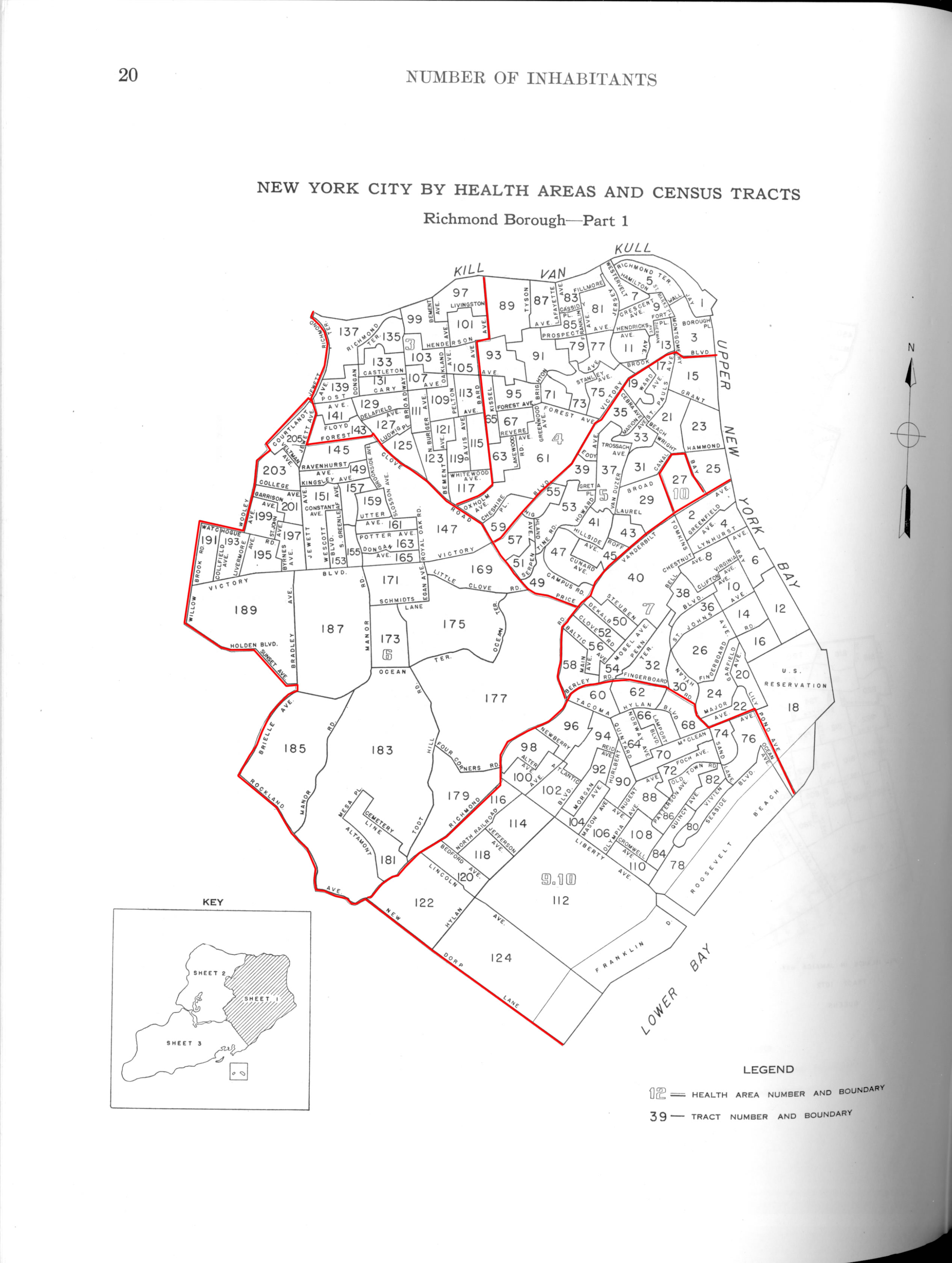
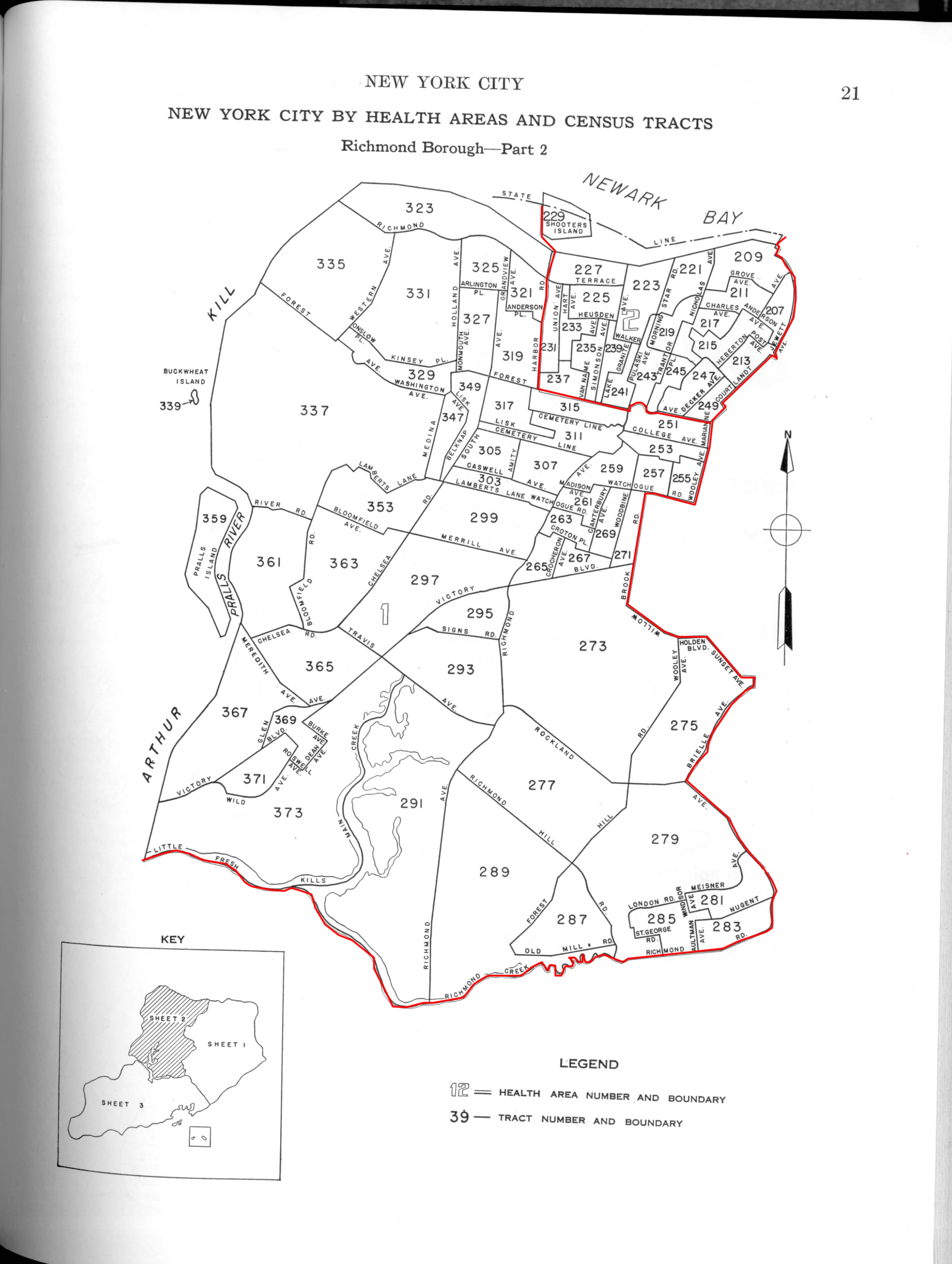
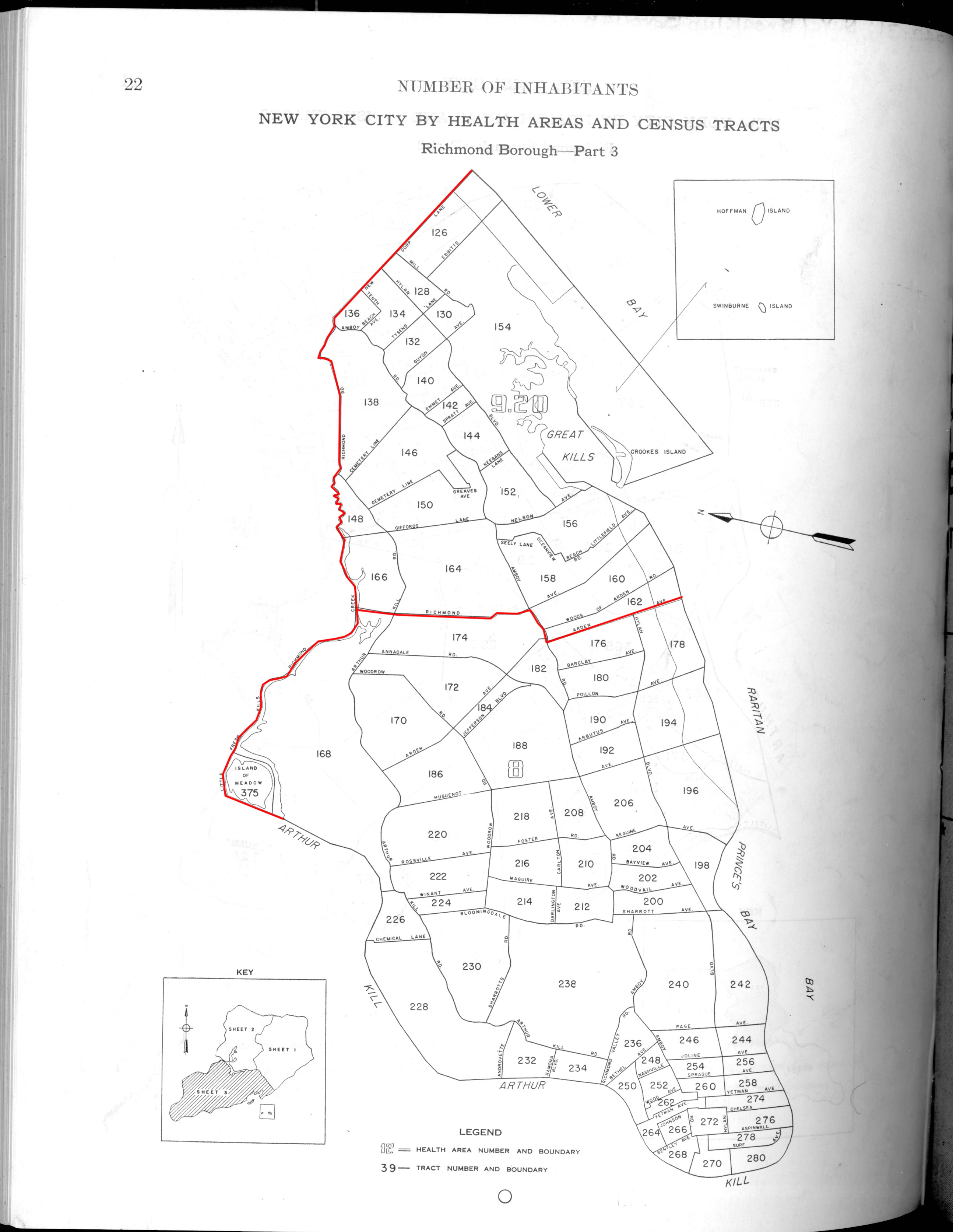
New York was divided into Census tracts and Health Areas, both divisions of which are displayed on the maps. Because it can be difficult to tell where the boundaries of the Health Areas are, we have created a version of the map with Health Areas picked out in red.
Bronx :
Brooklyn (We also have Housing: Supplement to the First Series Housing Bulletin for New York: Brooklyn Borough, New York City, Block Statisitcs):
Manhattan:
Queens:
Richmond: